

Field Pictures
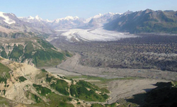
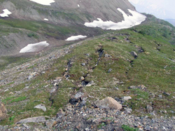
Capps Glacier forms the northern boundary of a current mapping effort in the Tyonek area, western Cook Inlet, by the Alaska Division of Geological & Geophysical Surveys. Capps Glacier and its tributary glaciers drain the northern flank of Mount Spurr, an active volcano. Arcuate morainal belts and associated outwash alluvium were deposited by Holocene advances of the glacier.
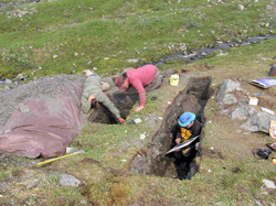
Gordon Seitz (USGS), Tom Richardson (Alaska Division of Geological & Geophysical Surveys) and David Schwartz (USGS) engaged in a paleoseismic trench study in the Chistochina Glacier area to identify and study evidence for past earthquakes along the Denali fault.
Squeak!
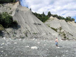
Contract geologist Dick Reger stands at the base of thick deposits of glacioestuarine sediments exposed in coastal bluffs near Granite Point, western Cook Inlet. The glacial and glacioestuarine deposits preserved in this coastal lowland are believed to date from late in the Naptowne glaciation (last major glaciation) and from the Holocene. New geologic investigations and mapping carried out by Dick and the Alaska Division of Geological & Geophysical Surveys in 2009 and 2010 will be an important contribution to understanding of the Quaternary history of western Cook Inlet.
Ground cracks and associated downslope mass movement developed on Holocene lateral moraine of the west fork of the Chistochina Glacier as a result of the 340-km-long magnitude 7.9 Denali fault earthquake on November 3, 2002. This event was associated with more than 5 m of right-lateral offset, causing significant damage to transportation corridors and many communities, as well as impacting the Trans-Alaska Pipeline.
Above photos and captions by De Anne Stevens
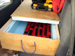
Core haul from day 2. In the end, we had 8 drives, with about 6.5 m of core.
David Klein is the project motivator and facilitator; we spend three very comfortable nights at his cabin.
Above photos and captions by Nancy Bigelow
Quartz Lake, March 2010
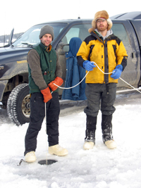
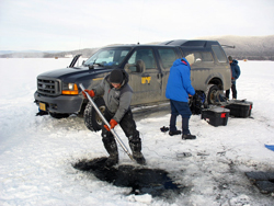
Ben Gaglioti and Mat Wooller getting ready to drop the hammer core into the sediment.
Sean Brennan cleaning the Livingstone with David Klein in the background.
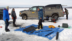
Everybody is working. From left to right: David Klein, Sean Brennan, Ben Gaglioti, and Nancy Bigelow.