

Charting ‘Streams as Sensors’ of Climate Change with the Arctic RIOS Project
November 7, 2023
Haley Dunleavy
907-474-6407
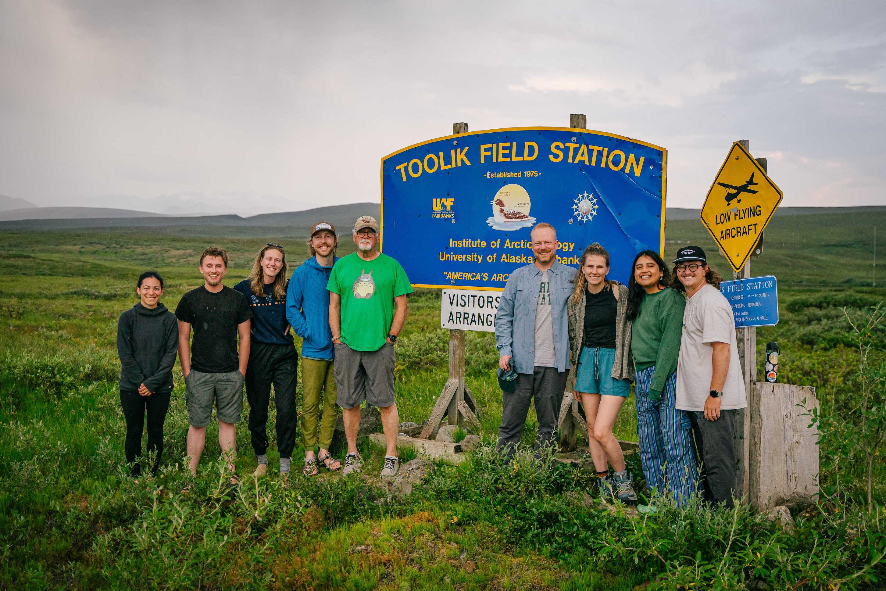
The Arctic RIOS project team (from left to right), Arial Shogren, Jackson VerSteeg, Abigail Rec, Paden Allsup, Breck Bowden, Jay Zarnetske, Amelia Grose, Valeria Prieto, and Jansen Nipko, stand by the Toolik Field Station sign during their final field season in summer 2023.
Fly over Alaska’s Arctic tundra and you’ll see one ever-present feature: water. It inundates almost all areas of the environment. As in other biomes, all that water is essential to sustaining a functioning ecosystem.
But now, as climate change rapidly alters the Arctic, researchers at Toolik Field Station are diving in to study how the Arctic’s river networks can be used to understand what’s happening to the whole landscape. To do so, they’re revolutionizing the ways scientists study streams, using new approaches to data collection and analysis. Even more, they’re finding that these new methods can pinpoint, within the vast expanse of tundra, hotspots of change.
The National Science Foundation-funded project, Arctic RIOS, short for River Integrated Observations through Synoptic Sampling, is grounded in the idea that a river’s chemistry tells a story. That story isn’t just about the river itself, but also about the whole landscape surrounding that river.
With the Arctic becoming warmer and wetter, the landscape is getting “more leaky,” said Jay Zarnetske, a hydro-ecologist at Michigan State University who started up the RIOS project in 2016. Those leaks eventually flow into stream networks, transporting dissolved chemicals. These chemicals can reveal processes happening on land, just by looking at concentrations within the rivers.
“We're trying to use the river network as a sort of distributed sensor network — to go out, see how different landscapes are leaking, what are they leaking and does that change through time,” Zarnetske said.
The RIOS group is particularly interested in what these leaks can tell us about carbon loss from climate-related change. Permafrost thaw, increased rain and wildfires all create new sources of carbon leaks and could contribute to global greenhouse gas levels, potentially acting as a significant driver of future warming. But when and where this carbon will be lost and how much is still uncertain.
It's a question that Arial Shogren, a stream ecosystem ecologist at the University of Alabama, said keeps her up at night.
“There's carbon leaking all the time, everywhere. But there are some watersheds and some moments in time where it's coming from a very specific place,” Shogren said.
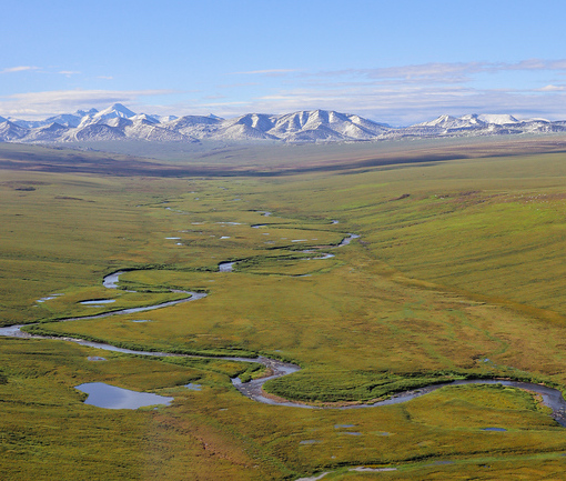
The Kuparuk River in Alaska, one of the Arctic RIOS project's study sites, meanders through tussock tundra in contrast to the lake-speckled Oksrukuyik Creek in summer 2022.
Take, for example, Oksrukuyik Creek near Toolik Field Station. Researchers have studied the chemistry at its outlet since the late 1980s. But Shogren, Zarnetske and collaborators at Brigham Young University and University of Vermont upped the scale of data collection on it with their project, sampling multiple sites along the whole length of the catchment repeatedly throughout the thaw season in a method known as synoptic sampling.
“Now, we can get into the nitty gritty of where in the landscape we are seeing either high or low concentrations that are emanating from [specific zones],” she said.
The project has found by looking at Oksrukuyik’s chemistry above and below an active thermokarst, that this one disturbance is driving a lot of what’s happening in the whole watershed, Shogren said.
Similarly, the lakes embedded within creek’s flow path also have a large influence on water chemistry. When analyzed using the RIOS group’s new methods, they find that lakes act as a reactor on the landscape, changing the biogeochemistry of what’s exported from them, Shogren said. That conclusion wouldn’t have been able to be made just from its outlet chemistry.
“We all have this intuition that [lakes] are a big player, but it's clear now they’re very influential in the stream network. So now we need to figure out why and how,” said Zarnetske.
New metrics tell a new story
Arctic RIOS has also increased the frequency of data collection by orders of magnitude, measuring the concentration of carbon and nitrogen being exported by three watersheds every 15 minutes using high-frequency sensors installed at catchment outlets. Combined with the synoptic sampling, it packs a detailed portrait of how carbon and nitrogen are moving across the landscape.
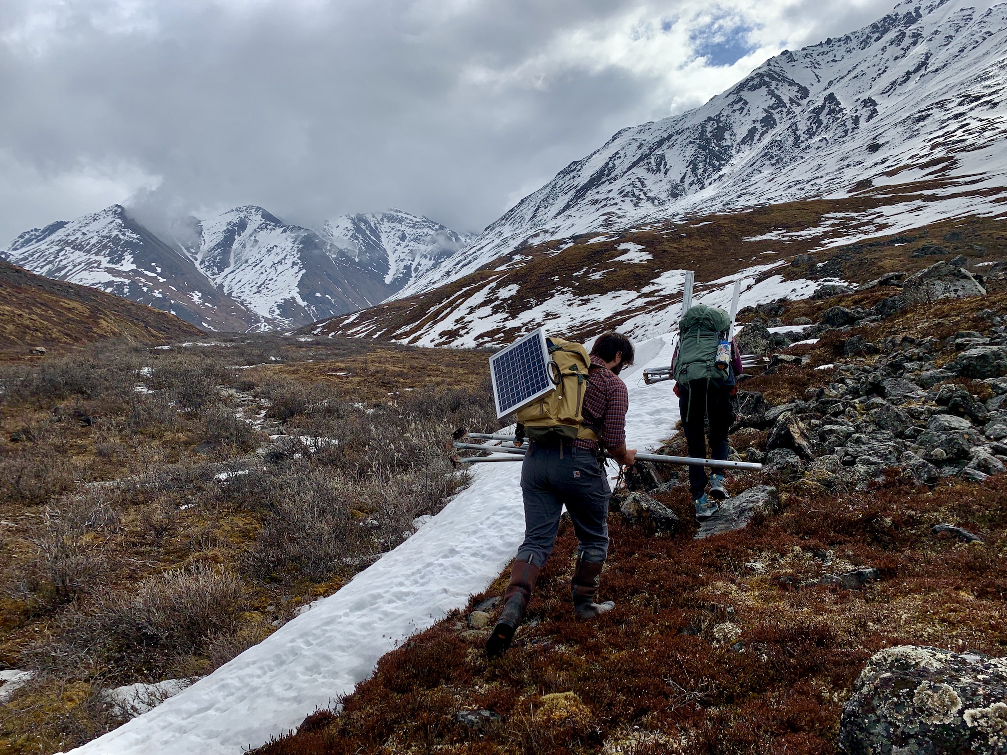
Once snow from the long Arctic winter begins to melt in late May, the Arctic RIOS team hauls solar panels, weather station equipment, and in situ stream chemistry sensors into the Brooks Range to measure the rapid seasonal changes.
“It's pretty rare to have both spatial and temporal data collected in this way,” Zarnetske said. It even required them to create new ways of numerically analyzing stream data. Ben Abbott, now an ecosystem ecologist at Brigham Young University and the lead of the Arctic RIOS project, took on that task as a postdoctoral researcher with Zarnetske. In the end, Abbott and Zarnetske created three new metrics that summarize how a watershed’s chemistry changes across time and space.
Ultimately what Shogren, Zarnetske, Abbott and others are finding is that Arctic watersheds vary in seemingly all ways possible — through time, between sub-catchments and especially among different watersheds. Add in the variable of climate change, and the stories become more complex.
Even single events can heavily influence carbon and nutrient fluxes in river networks. For example, the influence of tundra wildfires, which are becoming more frequent, is long-lasting. Abbott and collaborators found that organic nutrients and carbon leaked more from burned watersheds than from unburned, even 10 years post-fire.
Similarly, storm events also have a large effect and are projected to happen more often, especially in the shoulder seasons. If the project’s high-frequency sensors weren’t there, recording data after storm flushes in the Kuparuk watershed one year, the team would have underestimated total annual dissolved organic carbon export by a whopping 49%.
“The river can gush and be down within one day,” Zarnetske said. “It can move a month's worth of water. If you're not looking and detecting during that time, what do you miss in terms of how the system works or in terms of carbon budget?”
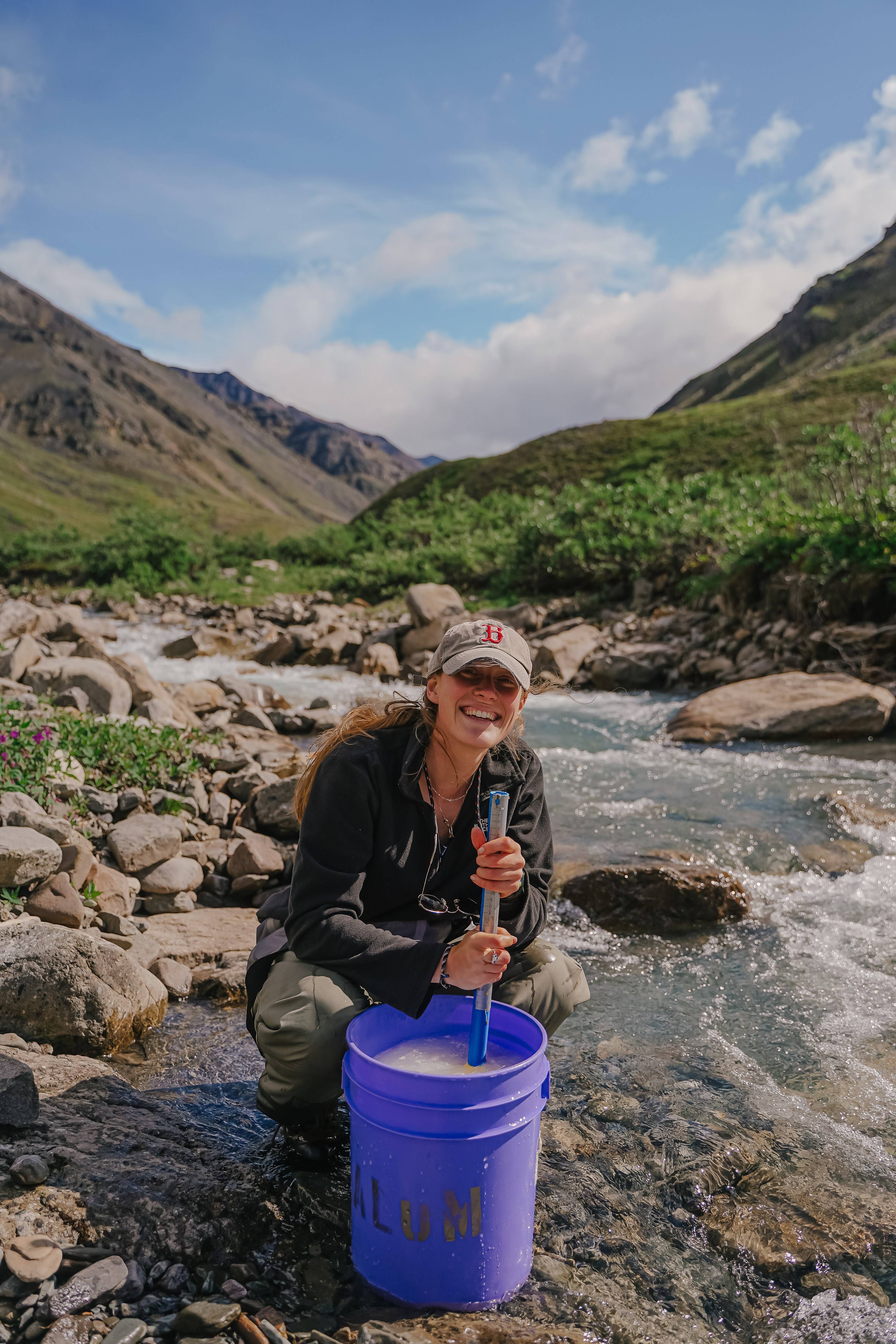
Doctoral candidate Abigail Rec, from University of Vermont, smiles as she stirs a salt slug mixture near Trevor Creek in the Brooks Range in July 2021.
Re-thinking models
The project wrapped their current grant’s final season of fieldwork in 2023. But there’s still more to be done. Some of their next steps include better understanding what the biogeochemical processes are that are creating these hotspots of change. Abigail Rec, a PhD candidate at the University of Vermont has run several experiments in the project’s study catchments to disentangle stream ecosystem functions like metabolism that will provide more insight on carbon budgets throughout the whole watershed.
The team is also employing machine learning algorithms to better predict river chemistry, and ultimately carbon losses, from watershed attributes. Shogren said these algorithms mostly show that physical characteristics, like slope, lake area and season, matter more than biological ones. “It's less based on the vegetation structure than we might have expected,” she said.
Lastly, the crew is working to change how the Arctic is represented in landscape models. Some watersheds that researchers use as representative in landscape models, like the well-studied Imnavait Creek, may not actually be all that representative of the larger region, Zarnetske said. “We've made a very clear case that different landscapes matter. It's going to be very hard to homogenize these systems.”
Shogren agreed. In order to predict the fate of carbon and nitrogen in these systems, scientists have to stop treating river networks as all alike, she said. “There are fundamental physical drivers that control the biogeochemistry that comes off of these river systems. That needs to be accounted for instead of just saying ‘This is an Arctic permafrost river,’” she added. “There's more to it than that.