


Research Focus
Our group investigates the Earth using radar remote sensing techniques. Our main interests lie in the development of advanced SAR, InSAR, PS-InSAR, and PolInSAR techniques and their application to geophysical problems.
We specialize on a holistic approach to radar remote sensing with the goal of estimating ionospheric, tropospheric, and geophysical parameters simultaneously. To this end, our research has focused on atmospheric and ionospheric modeling as well as the integration of geophysical models into SAR and InSAR processing.
Teaching
- GEOS 657 – Microwave Remote Sensing
Related links
Hazard monitoring
SARView Project
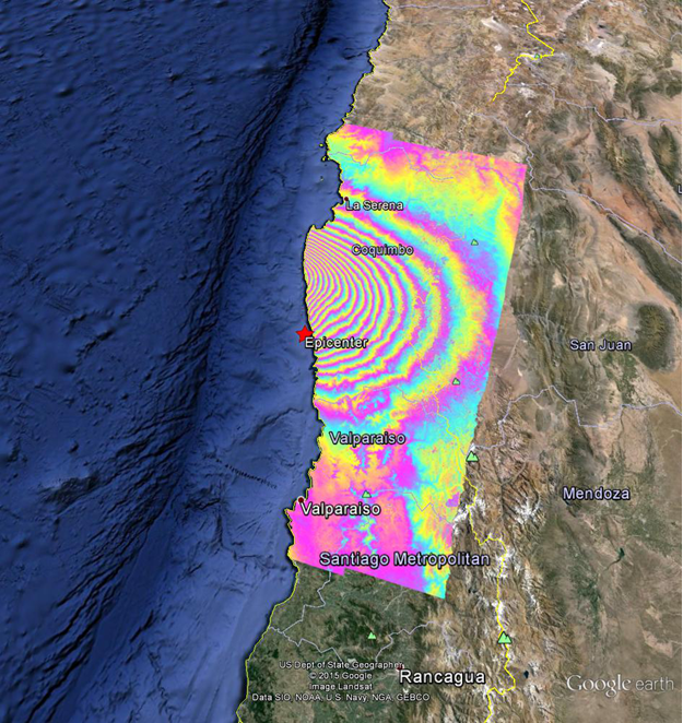
Ground deformation caused by the M8.3 Chile earthquake on 2015-09-16 22:54:33 (UTC) is demonstrated by this rewrapped interferogram processed from Sentinel-1A data and overlaid on Google earth. The image uses synthetic aperture radar (SAR) data from Aug. 24 and Sep. 17, 2015. Each colored fringe indicates about 8.5 cm of surface deformation in satellite line-of-sight direction.
AK-ARISE