

UAF researcher to lead four-year project to revolutionize seismology
Rod Boyce
907-474-7185
Sept. 3, 2021
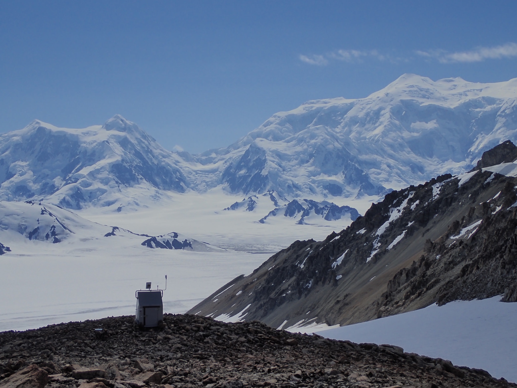
Seismic station TA.O28M sits on Mount Upton, in Canada's Yukon. Seismic stations, often remote, continuously record the subtle motion of the ground as well as the not-subtle ground motion during earthquakes.
A project to unite seismic data analysis and modeling with supercomputing power may help answer some of the biggest questions about the Earth’s seismic activity.
A University of Alaska Fairbanks Geophysical Institute researcher will lead the four-year, multi-institution project. The Seismic Computational Platform for Empowering Discovery, or SCOPED, project involves five universities: UAF, University of Washington, Columbia University, University of Texas and the Colorado School of Mines.
UAF associate professor of geophysics Carl Tape is the principal investigator on the $3.2 million project, funded through the National Science Foundation’s Office of Advanced Cyberinfrastructure.
“Certain problems in seismology, such as imaging the Earth's interior, depend on having a large amount of data from recording seismic waves at the surface,” said Tape, who is also affiliated with the UAF College of Natural Science and Mathematics. “In order to make use of the data, we have to be able to correctly understand and model it.”
Seismic waves can reveal information about the material of the Earth through which they are passing. The waves have many sources: natural events such as earthquakes, volcanic eruptions and avalanches, for example, and human-caused events such as nuclear explosions.
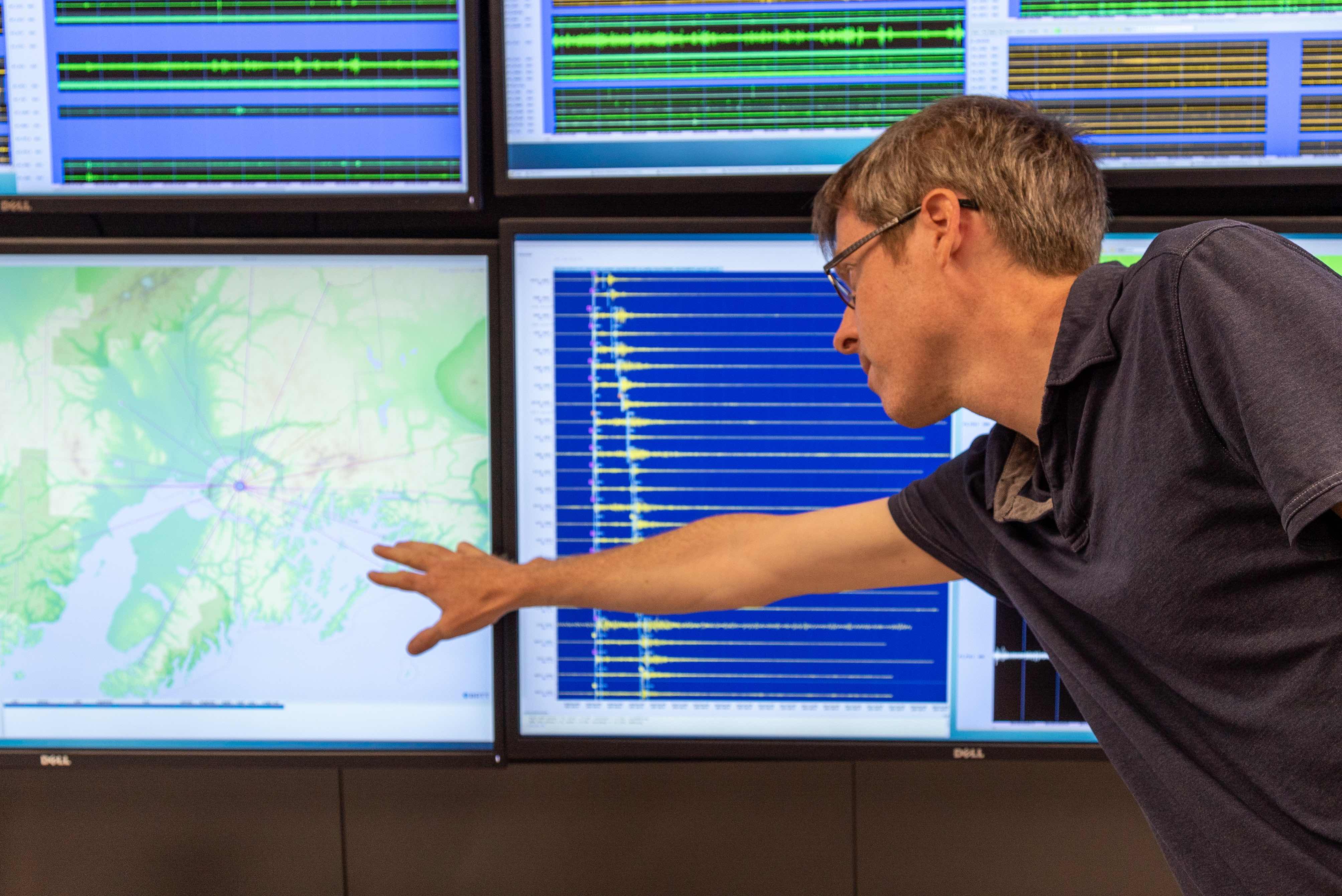
The Geophysical Institute’s Carl Tape talks about a small earthquake that occurred in the Anchorage area on Monday, Aug. 31, 2021.
Analyzing all the data from those waves requires the use of high-performance computing, or supercomputing.
“To provide the most accurate information possible about what's underneath the surface of our Earth, whether it's an active fault or an oil and gas reservoir, for example, we need to use the most sophisticated computational tools,” he said.
Some of that computing will involve use of UAF’s Chinook high-performance computing cluster and machines at the Texas Advanced Computing Center at the University of Texas. Some of the work will occur in the cloud, which is the use of remote servers to store data and provide other computing services.
The project aims to serve research in four interconnected and data-heavy areas: seismic imaging of Earth’s interior, waveform simulation of earthquakes and Earth structure, monitoring of Earth structure using ambient noise, and precision monitoring of earthquakes and faults.
SCOPED ultimately could provide scientists with essential information as they continue looking for detailed answers to questions such as these:
• How did Earth’s continental crust evolve over millions of years?
• How do Earth’s subsurface structures change and evolve over seconds to weeks?
• What are the dynamics of volcanic systems, especially leading up to eruptions?
• What controls the occurrence of earthquakes?
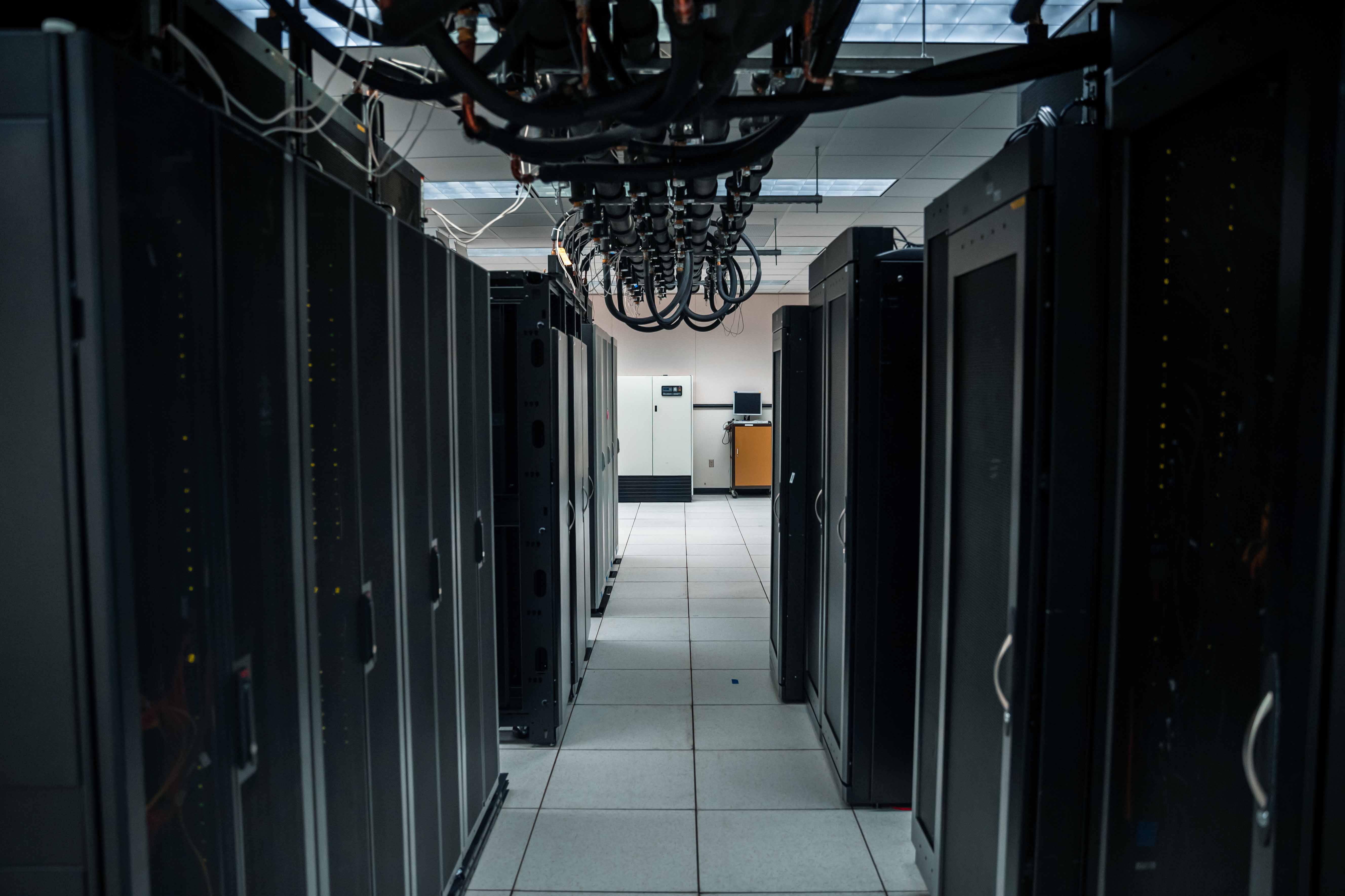
This high-performance computing cluster at the University of Alaska Fairbanks contains stacks of thousands of machines. These machines can analyze large volumes of data and also support physics-based simulations such as seismic wave propagation.
The project will establish a database of existing raw seismic data and research-grade data products for seismologists and will provide universal access through a gateway that makes the data usable without regard to the user’s computer platform.
“We're not creating any data. We're not even creating any software, but we're pulling things together in a way that people can do new science and empower discovery with these tools,” Tape said.
The project is the culmination of a recognition a decade ago that the science of seismology couldn’t advance without exploiting newly available computing power. The problem was the subject of a two-day workshop in 2012 attended by Tape and others and hosted by Lawrence Livermore National Laboratory.
“We're not going to make the steps forward that we need in the field without large organized efforts,” Tape said. “You can be successful at archiving data, and you can be successful at code development, but how can we bring these two things together? How can we use these modeling capabilities, together with these large datasets, to say something valuable about the physics of earthquakes or the structure of the Earth?”
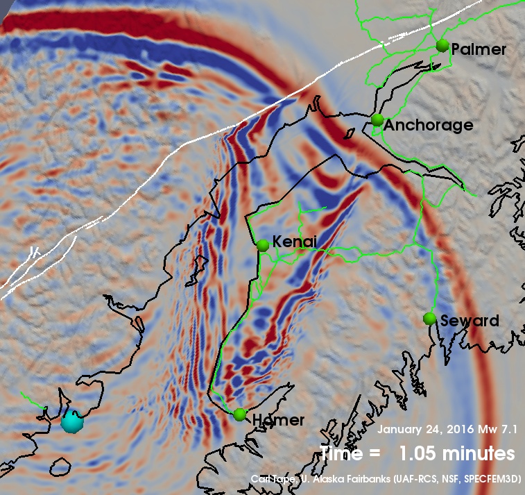
A snapshot of a 2016 computer simulation of an earthquake shows the complex interaction between seismic waves and the geological structures of Southcentral Alaska. A video of the simulation is available at https://youtu.be/KdiETNfyaUo.
Others involved in SCOPED include Ebru Bozdag at the Colorado School of Mines, Marine Denolle at the University of Washington, Felix Waldhauser at Columbia University and Ian Wang at the Texas Advanced Computing Center at the University of Texas.
ADDITIONAL CONTACT: Carl Tape, University of Alaska Fairbanks Geophysical Institute, 907-474-5456, ctape@alaska.edu
NOTE TO EDITORS: Photographs and images are available at gi.alaska.edu.