

Alaska Satellite Facility gets $139 million federal intelligence contract
Rod Boyce
907-474-7185
June 6, 2024
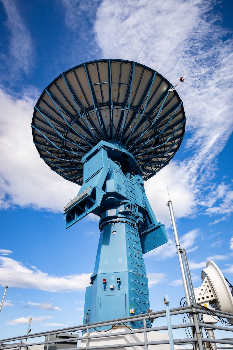
The antenna known as AS2 sits atop the Elvey Building at the University of Alaska Fairbanks. The antenna has a 9.1-meter aperture.
The National Geospatial-Intelligence Agency has awarded a $139 million, five-year contract to the University of Alaska Fairbanks for the global collection and processing of elevation and 3D data about Earth’s surface.
The NGA, part of the U.S. Department of Defense, provides global geospatial data and geospatial intelligence to assist policymakers, military service members, the intelligence community and first responders.
The work will be carried out by the Alaska Satellite Facility, a unit of the UAF Geophysical Institute that is part of the GeoData Cooperative, a group of public and private organizations.
“We are working closely with our GeoData Cooperative partners to provide the global-scale, highly accurate 3D products that the Defense Department requires to provide U.S. and allied military personnel as safe an environment as possible in which to operate,” ASF Director Wade Albright said.
The contract was reached through the Geophysical Institute’s University Affiliated Research Center.
The Defense Department designated the University of Alaska system as a University Affiliated Research Center in 2018, assigned to focus on the geophysical detection of nuclear detonations. The Geophysical Institute operates the UARC.
The Defense Department has 15 UARCs nationwide. The Geophysical Institute UARC is the only one tasked with the geophysical detection of nuclear proliferation.
The Geophysical Detection of Nuclear Proliferation UARC contracts for work in its four core areas of expertise:
• Nuclear treaty verification: Theoretical and practical understanding of techniques and technologies related to verification of compliance with the Comprehensive Nuclear Test Ban Treaty.
• Measurement and signature intelligence: Theoretical and practical understanding of techniques and technologies related to signal processing and analysis and geophysical measurement of an object or signal source to detail its characteristics.
• Geospatial intelligence. Theoretical and practical understanding of techniques and technologies related to collecting, analyzing and interpreting data about the Earth’s surface for use by decision-makers.
• Geophysical research: Basic and applied geophysical research in the solid earth, atmosphere, cryosphere, oceans, unmanned aerial systems and space.
Geophysical Institute Director Robert McCoy, who is also the UARC’s director, has seen the UARC grow in the few years of its existence. And he wants it to grow further.
“I like to think of us as being an Arctic UARC. I want us to be the go-to place for the Department of Defense in the Arctic,” McCoy said.
The NGA in 2021 provided the Alaska Satellite Facility with a high-performance computing cluster designed for processing satellite imagery. The computers can process image data faster and produce elevation content in greater detail than current systems.
That computing cluster serves a different purpose from the Alaska Satellite Facility’s other function, which is the acquisition of synthetic aperture radar data from NASA’s Earth Observing System satellites for use by public and private researchers and others.
ADDITIONAL CONTACTS: Robert McCoy, rpmccoy@alaska.edu; Wade Albright, rwalbright@alaska.edu
225-24
