

Alaska’s water crop is a natural resource

The author’s dog Cora rides a canoe on the Yukon River. Two-thirds of all the flowing water in Alaska makes its way into the Yukon.
As much of Alaska’s landmass crosses the magical temperature threshold that turns ice and snow into water, it’s time to consider the state’s richness in a resource more essential to humans than oil or gas.
Clear as gin, brown as iced tea or tinted aquamarine by glacial dust, Alaska’s freshwater supply is so abundant the numbers are hard to comprehend.
“With an annual runoff of 650 million acre-feet (plus 150 million acre-feet inflow from Canada) Alaska has about one-third the total . . . of the entire United States,” wrote Charles Hartman and Philip Johnson, editors of the 1978 Environmental Atlas of Alaska. An acre-foot equals 325,851 gallons, the amount of water it takes to cover 1 acre to a depth of 1 foot.
Those numbers include the outflow of the nation’s third-longest river — the swelling and soon-to-break-out-of-its-icy-shell Yukon, which by itself drains one third of the land mass of Alaska.
The writers of the environmental atlas also pointed out that Alaska has 94 freshwater lakes with a surface area of 10 square miles or more.
Iliamna Lake attracts red torpedoes of sockeye salmon up the Kvichak River in southern Alaska. It is 988 feet deep, spreads over more than 1,000 square miles of the Alaska map and is America’s 10th-largest lake.
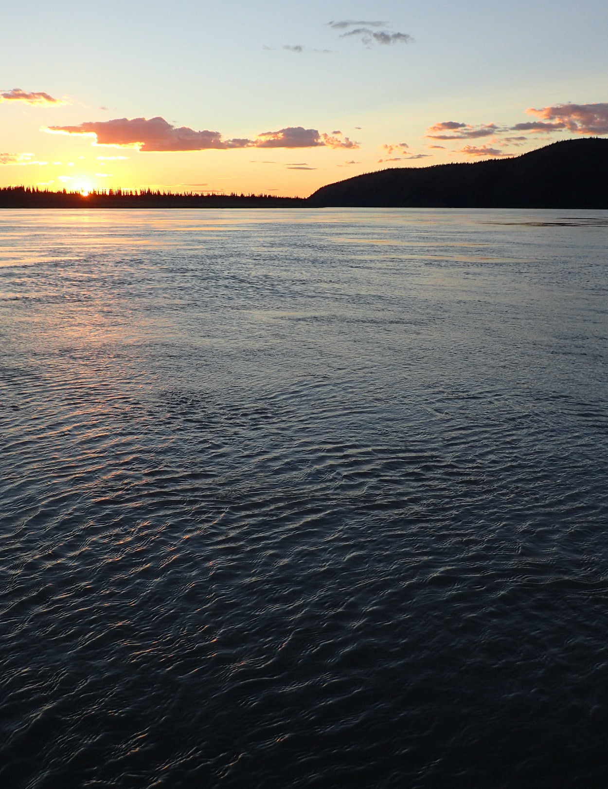
The Yukon River flows toward Circle, Alaska.
Becharof Lake — which I had to look up despite the fact that it almost cuts the Alaska Peninsula in half — is the 14th largest lake in America, just after Lake Champlain (which I did not have to look up, because I grew up in New York).
Apologies to Minnesota, but Alaska license plates could read “Land of 3 million lakes.” A vast majority of those dark-water basins are unnamed.
True, most of Alaska’s lakes aren’t so good for swimming; swamps surround them and mosquitoes lord over them. But billions of songbirds are now on their way to feast there, where few people dare to venture in summertime.
Alaska has more water stored in glaciers than anywhere outside of Greenland and Antarctica. If you could airlift Alaska’s thousands of glaciers and set them down on top of Maine, that state would very much resemble Greenland — an ice cap circled by a thin ring of rock.
Each summer, Alaska’s glaciers raise the level of the planet’s oceans with staggering amounts of meltwater, unlocked after hundreds and thousands of years as blue ice. That liquid is one of Alaska’s underrated resources.
“Alaska has a tremendous water crop,” Hartman and Johnson concluded in their report 44 years ago. “Essentially none is used at present.”
An entrepreneur once tried to remedy that. During his second term as Alaska governor in the 1990s, Wally Hickel proposed exporting some of Alaska’s freshwater to California. He envisioned an undersea pipeline that would carry water from either the Stikine River in Southeast Alaska or the Copper River near Cordova to California.
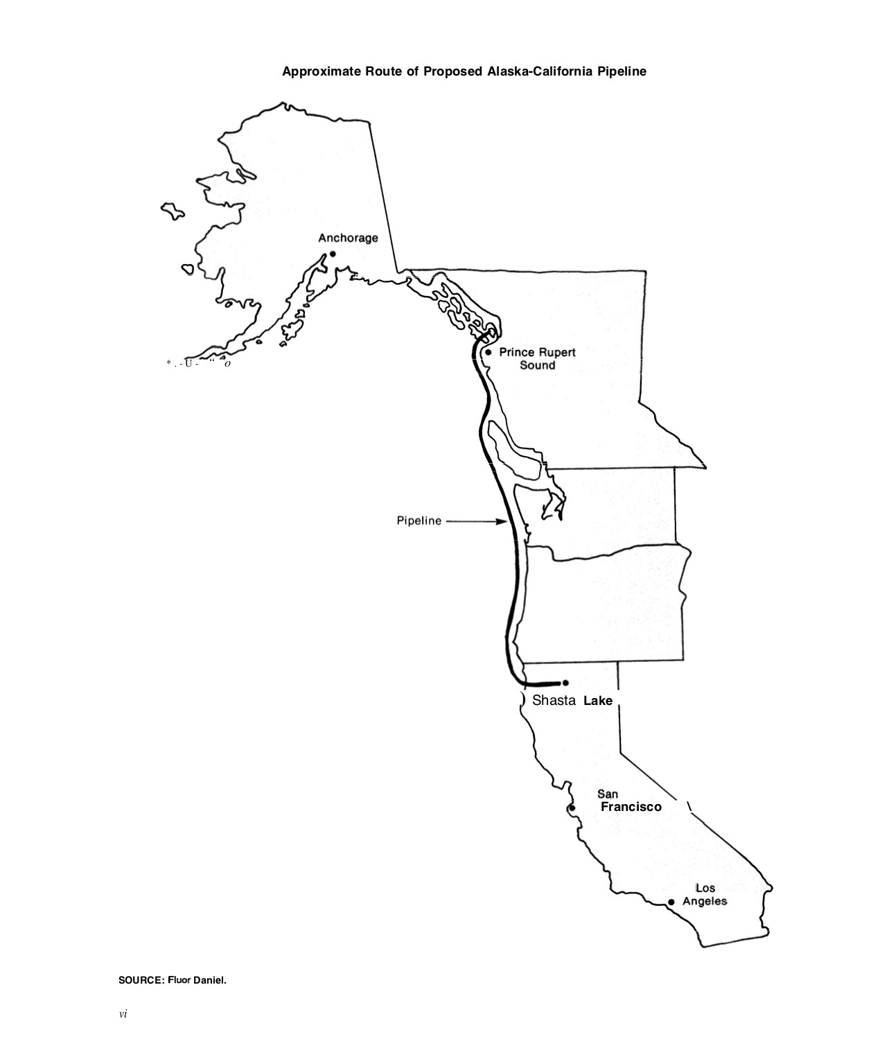
An undersea pipeline, sketched on this 1992 map from the U.S. Congress Office of Technology Assessment, would have carried water from Southeast Alaska to northern California.
That pipeline would have been more than 1,400 miles long (compared to the 800 miles of the trans-Alaska pipeline). Most thought the idea was nutty, but members of the U.S. Congress Office of Technology Assessment gathered in Los Angeles in 1991 to see if the pipeline was feasible. Gov. Hickel attended that meeting.
In the end, the assessors concluded that the Alaska water pipeline was too costly an option to relieve California drought, but they did not rule out an Alaska water pipeline forever. Especially if a warming climate — then being noticed by scientists — caused more water crises in the West.
“Although there is no current or near-term demand for expensive water from Alaska, the possibility that such water might eventually be needed cannot be completely dismissed,” they wrote.
Since the late 1970s, the University of Alaska Fairbanks Geophysical Institute has provided this column free in cooperation with the UAF research community. Ned Rozell is a science writer for the Geophysical Institute.