Life on ice, two miles thick
Life on ice, two miles thick
Submitted by Ned Rozell
Phone: 907-474-7648
05/14/08


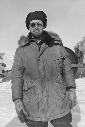
Fifty years ago, Charles Bentley and five other young men chugged across the ice of
Antarctica in three tracked vehicles, exploring the mysterious white continent. In
those days when frontiers existed on the planet, Bentley and his comrades saw a mountain
range ahead of them that had Rocky-Mountain-size peaks with no names.
"We were the first ones to see almost all those mountains," Bentley said during a
recent trip to Fairbanks. "We were traveling about 24 miles a day, and we thought
each day, "tomorrow, we’ll get to the mountains." But they were 200 miles away. It
was quite a sight to watch these magnificent
mountains gradually come up on the horizon."
He and his traveling companions gave a few of the peaks their names, which remain
on today’s map.
"I thought we were playing a joke (naming the mountains after themselves)," he said.
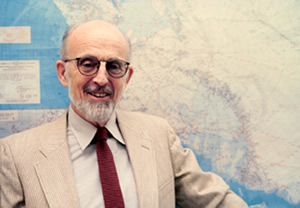
But the names stuck. Bentley, now 78 and a professor emeritus at the University of
Wisconsin-Madison, now has two features named after him in Antarctica: Mount Bentley,
about 14,000 feet above sea level, and the Bentley Subglacial Trench, 8,327 feet below
sea level, the lowest point on
Earth¹s surface not covered by ocean (because ice fills it). Mexico could hide in
the under-ice canyon that bears Bentley¹s name.
"I claim to be the only person with a hill and a hole named after him," Bentley said.
During that first traverse across Antarctica in 1957, Bentley and his partners made
another discovery, perhaps more startling than the unknown mountain range"¹in some
areas, Antarctica was so thickly covered with snow and ice that it was two miles down
to bedrock.
"The general belief at the time was that all of West Antarctica was a mountainous
land (covered by snow and ice), and that as soon as we got off the ice shelf, the
mountains would come up," Bentley said. "Instead, (the bedrock level) went down, and
was thousands of meters below sea level. That was totally startling."
The researchers made the discovery by drilling holes in the ice, dropping in a pound
of explosives, and seeing how long it took for the seismic signal to return from bedrock.
Up to three miles thick in places, ice burdens the "isostatically depressed" continent
so that if it melted, the land beneath would rise about 1,500 feet. The thickest ice
on Antarctica--and in the world--is about 15,700 feet thick.
Bentley was so intrigued with the extent of the ice that he signed up to stay in Antarctica
another season. Fifty years later, he has since evolved into one of the world’s experts
on the continent, and he is still traveling there, having returned this January as
part of a University of Wisconsin team. Bentley has stood on Antarctica in six consecutive
decades. And what
changes has he noticed in that time?
"Marvelous old planes from the 30’s are still flying around," he said. "And field
camps always seem to have good cooks, just like they used to ... The ice changes are
too large in scale to see. By inspection (from the ground), you’re never going to
see any differences.
"Changes in the ice sheet may be hard to see, but they are measurable and they are
accelerating, contributing to global sea-level rise," he said. "The world ignores
Antarctica at its peril."
This column is provided as a public service by the Geophysical Institute, University
of Alaska Fairbanks, in cooperation with the UAF research community. Ned Rozell is
a science writer at the institute. To view past columns or to subscribe, visit www.gi.alaska.edu/ScienceForum/index.html.


