

Large image view: University research in flight
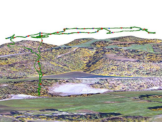
A computer graphic shows the path of the blimp as researchers shot photos of a gravel pit in Palmer from a height of 600 feet (183 meters). The blue dots represent points where the Canon camera took a picture and the red dots where the Olympus digital camera made an exposure.
Credit: Norman R. Harris
Filename: Blimp_Flight_May24.jpg
All images in the UAF Newsroom are protected by copyright and may not be downloaded or used without permission. If you are interested in obtaining permission to use an image from the Newsroom, please fill out the online image request form.