Webley's Volcanic Past

Image generated from Google Earth
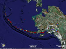
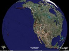
A snapshot from a Google Earth simulation shows the many volcanoes in Alaska that make up part of the Pacific Ring of Fire.
Peter Webley first became involved in volcanology when he did his doctoral research on Europe’s most active volcano, Mount Etna in Sicily. He worked at the Environmental Systems Science Centre at the University of Reading in England. Using data both from his fieldwork and remote sensing technology, he found his background in geophysics and atmospheric science were particularly useful for modeling physical and atmospheric aspects of volcanology.
While at the University of Reading, Webley used an atmospheric model to detect and fix errors which showed up when he used Synthetic Aperture Radar images and the Interferometric SAR technique to determine ground movement and anomalies that could indicate volcanic activity. The SAR data were distorted by atmospheric water vapor, which resulted in false reports of the ground deformations.
Webley developed a novel technique to use three-dimensional modeled atmospheric data as a filter to determine and then remove distortions. This was the first time anyone had used three-dimensional models to solve the problem of water vapor distortion on InSAR measurements, Webley said.
After completing his doctoral work, Webley’s first postdoctoral research project took him to Nicaragua and throughout Central America as part of a UK government Department for International Development-funded project, and even deeper into volcanology.
Webley developed a novel technique to use three-dimensional modeled atmospheric data as a filter.
The Ring of Fire, a zone of frequent earthquakes and volcanic eruptions encircling the basin of the Pacific Ocean, laps the coasts of North, South and Central America. As a service to the countries of Central America, his project helped install a volcano monitoring system using the same advanced very high resolution radiometer (AVHRR) feeds used here in Alaska. Webley developed the system to analyze thermal hotspot volcanic monitoring on the incoming data. This work led to the first localized operational volcanic monitoring system in Central America, complete with one antenna and three computers to receive, process and distribute the data.
Prior to Webley’s work in Nicaragua, scientists, policy makers and emergency responders across Central America did not have a single, reliable source of satellite data. The importance of making these computer models available is to help people understand and appreciate how information is gathered to create various disaster warnings. Through public access, Webley hopes people will not only gain a greater understanding, but more confidence, in the reliability of the information and where it’s coming from to warn the public in a credible way.


