

Satellite-based data
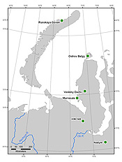
Image by Hilmar Maier/IAB/Alaska Geobotany Center.
Field research sites in the Yamal Peninsula are located at Nadyn, KM-143 and Vaskiny Dachi.
To detect global greenness scientists have relied mostly on the normalized difference vegetation index record from the Advanced Very High Resolution Radiometers, known as AVHRR, aboard National Oceanic and Atmospheric Administration weather satellites. These data are particularly valuable because the satellites cover the globe daily and the data have been available since 1982. The unique spectral nature of chlorophyll enables scientists to relate the spectral changes to plant productivity. The AVHRR sensors record reflectance in five portions of the electromagnetic spectrum. Green vegetation absorbs visible light for photosynthesis and strongly reflects near infrared radiation. Scientists use the difference in the reflectance of the near infrared portion and the visible portion as an index of plant photosynthetic activity.