3D mapping expands understanding of coastal erosion
December 10, 2019
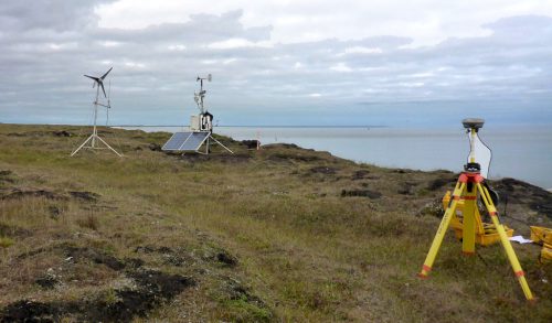
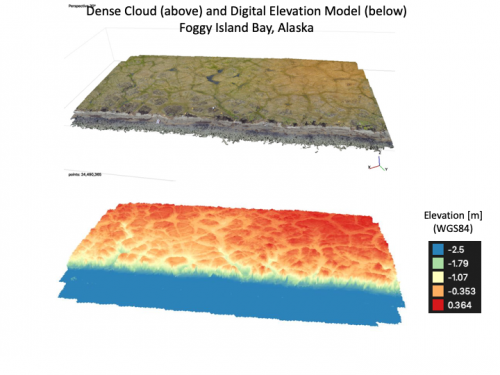
Research engineer Paul Duvoy has created a 3D digital elevation model of a 1.62-hectare area in Foggy Island Bay where a solar- and wind-powered meteorological station is maintained. Duvoy works for UAF's Alaska Center for Energy and Power.
Foggy Island lies off the coast of Alaska in the Beaufort Sea, east of Prudhoe Bay. The work is part of the U.S. Bureau of Ocean Energy Management-funded Central Beaufort Sea Wave and Hydrodynamic Modeling Study.
This area was surveyed aerially with a DJI Phantom 3 drone and on the ground with a Trimble RTK base and rover.
The local sea level was also measured using both the Trimble RTK equipment and a Sokkia Automatic Level, surveying rods, and an established monument.
ACEP deputy director Jeremy Kasper and ACEP researcher Stephanie Jump performed the land survey.
The effort assists researchers in their understanding of coastal change and erosion rates at the site.
For more information contact Jeremy Kasper at jlkasper@alaska.edu.