Marine advisory agent brings free large ship tracking to Nome
August 23, 2013
907-274-9698
8/23/13
Real-time information about ship movements near Nome is now available to the public online and free of charge. The University of Alaska Fairbanks Northwest Campus, the Alaska Sea Grant Marine Advisory Program and the University of the Aegean in Greece recently collaborated to install an Automatic Identification System receiving station in Nome.
The station collects data on the large marine vessels within 12 miles of the Nome harbor and uploads the information to an online map at the website www.marinetraffic.com. The data available on the website is provided by volunteers all over the world with public-access AIS receivers.

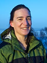
Gay Sheffield, a Marine Advisory Program agent and UAF School of Fisheries and Ocean Sciences faculty member, is responsible for bringing the technology to Nome.
“On the Internet was a community-based public access AIS receiver website that promised to ‘cover your area,’” said Sheffield. “So I wrote to them and told them that near Nome and the Bering Strait region, our large vessel traffic is increasing and forecasted to continue to increase. As promised, the University of the Aegean sent us the base station equipment - at no cost.”
The AIS is designed to increase maritime safety for ships by electronically broadcasting the identity, position and course of a vessel, thus helping other ships prevent collisions and assisting port authorities to better control maritime traffic. All vessels more than 300 gross tons and all merchant ships with passengers, regardless of size, have been required to carry an AIS transponder since 2004. The onboard AIS systems can be tracked by base stations located onshore and even by some satellites. The base station antenna in Nome is mounted on the UAF Northwest Campus main building, about 100 yards from the shore.
“We set ours up and plugged it in and blip; we got a spot on the map not only showing us the location of a cruise vessel but details about that particular ship,” said Sheffield, “It’s impressive, but there is much of Alaska’s coastline that needs public access receivers.”
Sheffield’s immediate reasons for acquiring the tracking system is to better understand local ship traffic near the Port of Nome, as well as to make the Bering Strait and other regions aware of community-based public access AIS capabilities.
Sheffield is enthusiastically spreading the word about the tool, “There is even a phone app!”
To see ships broadcasting AIS information that are within 12 miles of Nome today, visit Sheffield’s website at http://seagrant.uaf.edu/map/staff/sheffield.php. For worldwide ship traffic go to www.marinetraffic.com. For more information about Nome’s AIS, or if you are interested in setting one up in your Alaska community, contact Gay Sheffield, 907-443-2397, gay.sheffield@alaska.edu.
About Alaska Sea Grant
Alaska Sea Grant is a statewide marine research, education, and extension program at the University of Alaska Fairbanks School of Fisheries and Ocean Sciences. The Alaska Sea Grant Marine Advisory Program provides outreach and technical assistance to help Alaskans wisely use, conserve, and enjoy marine and coastal resources. Alaska Sea Grant is funded by the National Oceanic and Atmospheric Administration and by the University of Alaska Fairbanks with state funds, in partnership with private industry.
ADDITIONAL CONTACTS: Gay Sheffield, 907-443-2397, gay.sheffield@alaska.edu
ON THE WEB:
http://seagrant.uaf.edu/map/staff/sheffield.php
www.marinetraffic.com
seagrant.uaf.edu/map/
DM/8-26-13/041-14


