

App tells when it's OK to build ice roads
June 4, 2015
Sue Mitchell
907-474-5823
Alaska’s natural resource managers are using a web app developed at the University of Alaska Fairbanks to let oil field companies know when it's OK to build ice roads on the North Slope.
Notifying oil companies and contractors when it is safe to operate vehicles off-road to get to remote sites without damaging the fragile tundra is the responsibility of staff at the Alaska Department of Natural Resources' Division of Mining, Land and Water. Last fall, DNR contacted UAF's Geographic Information Network of Alaska, or GINA, to ask for assistance.
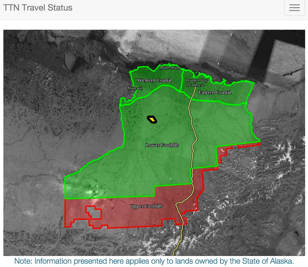
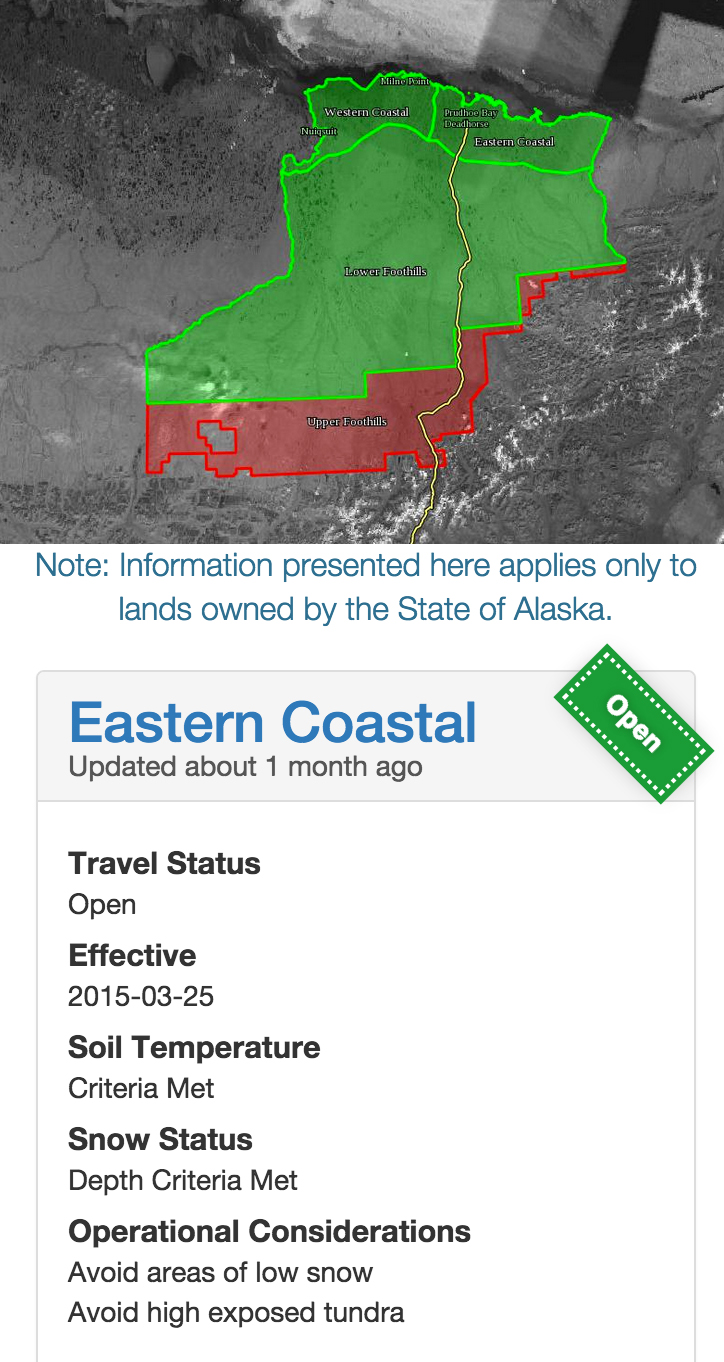
GINA, which is part of the UAF Geophysical Institute, built a web app that uses soil temperatures, snow depth and snow density data from multiple monitoring stations on the North Slope. DNR managers can use the new app to post the data from anywhere on the North Slope road system, and the results display immediately in an online map, said Melissa Head, a DNR natural resources manager. The app optimizes the entire process, giving information to contractors who want to start building an ice road, need to stop until conditions are appropriate or need to remove their equipment.
"It's useful to have our information getting out in multiple formats," Head said. "The North Slope contractors can quickly and easily grasp what's open and what's closed; they can see the areas in relation to the North Slope and in relation to their facilities."
An earlier application GINA developed for DNR several years ago consisted of two layers — a database-desktop interface and a slightly different mobile app. Funding lapsed and that interface was no longer being maintained. "We heard from people soon after the site went down last year," Head said. "I had quite a few emails and calls saying, 'Where did it go?' It's information they can go to any time."
Head and her colleagues at DNR contacted Dayne Broderson and his team at GINA to ask that they bring it back online, but in a more user-friendly format. The new interface is a single app that is optimized for mobile use.
"The app presents current status of the protected areas, and a manager login at the same website makes it possible for the DNR managers to keep the data up-to-date," Broderson said.
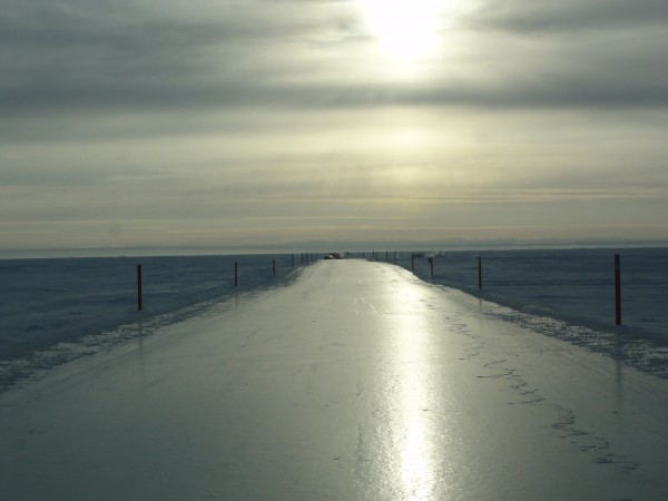
Since oil development began north of the Brooks Range in 1969, state and federal agencies have made observations and conducted experiments about how best to protect the fragile tundra ecosystem while facilitating exploration. The region is divided into two zones — coastal and foothill — and each zone into two areas. DNR guidelines state that the tundra can be opened to off-road travel and ice road construction in the coastal areas when the soil temperature at a depth of 30 centimeters (about 1 foot) reaches minus 5 degrees Celsius (23 degrees Fahrenheit) and when there is 6 inches of snow on the ground. In the foothill areas, tundra opening occurs when the soil temperature reaches minus 5 degrees C and there is 9 inches of snow on the ground.
Deeper snow coverage is required in the foothills because it has more tussocks, shrubs and hummocks, Head said. "It takes more snow to encapsulate those micro-topographic features. The snow and the cold soil are the only things that are going to protect the tundra" when vehicles travel on it, says Head.
There are at least four monitoring stations in each of the four areas. They are all accessible by road so DNR managers can get to them once a week to download the data and then transfer the results of their analysis to the online map.
This project was a relatively modest one for GINA, Broderson said, but still worthwhile.
"Making our services available for practical applications like this is taking advantage of (the university's) ability to serve the state," Broderson said. "Anything we can do to improve the efficiency of our agency partners is improving the whole industry."
"The tundra is a state resource," Head pointed out. "We do our best to keep damage to a minimum and try to come up with different techniques that allow companies to explore for oil and gas without leaving a negative imprint on the land."
 Photo courtesy of ADNR/DMLW
An ice road under construction.
WAS ON THE WEB AT: http://ttn.gina.alaska.edu/
ADDITIONAL CONTACT: Dayne Broderson, 907-474-6182, https://gina.alaska.edu/