Researchers study sea otters with unmanned aircraft
June 3, 2015
Sue Mitchell
907-474-5823
Watching marine life to gather data about behavior and abundance can be tedious and
time-consuming for researchers, but recent studies indicate unmanned aircraft may
offer a way around such obstacles.
University of Alaska Fairbanks scientists conducted two field studies to see if unmanned
aerial vehicle cameras at various altitudes can take high-resolution photographs of
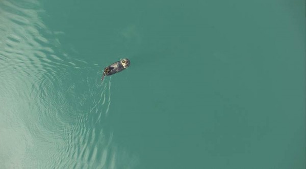
beaches at low tide and hover above sea otters without disturbing them.
“For the most part, the otters didn’t care,” said Brenda Konar, a professor at UAF
School of Fisheries and Ocean Sciences. “Some would slowly swim away, but most were
more interested in eating.”

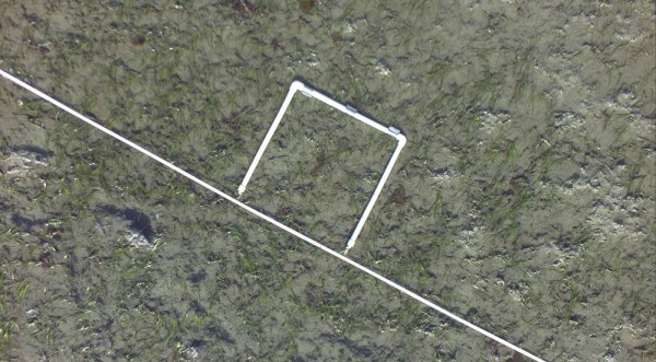
UAF School of Fisheries and Ocean Sciences researchers asked a team from the Geophysical Institute’s Alaska Center for Unmanned Aircraft Systems Integration to help them to be more efficient and collect better data on two different studies. The first study, with the U.S. Geological Survey, was to see if UAV cameras can take high-resolution video while hovering above sea otters to watch them feed without disturbing them. The second study used unmanned aircraft to take photos of beaches at low tide to help make a monitoring program more efficient. If these trial studies prove useful, this technology could be used in many regions.
ACUASI sent two small rotary wing aircraft to conduct the field tests in Homer, Alaska.
“We want to record what plants and animals are living on these beaches now so that we can monitor natural changes and changes that may be occurring with climate,” Konar said. “This will let us see what changes happen in the case of a big event, such as an oil spill.”
Traditional beach fieldwork for the monitoring studies means Konar, Katrin Iken of SFOS and their team wait until the tide goes out to place a PVC pipe grid on the uncovered shore. Researchers then count snails, sea stars, kelp, clusters of sea grass and other living things in the quadrats.

“We want to observe changes that are natural,” Konar said. “Then we’ll know what changes happen in the case of a big event, such as an oil spill.”
Work on one beach takes about four hours and ends when the tide comes back. The short time period also limits how much of the beach they can look at. Unmanned aircraft should be able to gather more data, she said.
The tide mission had successes and setbacks, but this is to be expected in science, said Sam Vanderwaal, an ACUASI engineer and project manager.
“We were able to fly and get data, but we needed higher resolution for the images,” he said. “It was a proof of concept and we think we can get better details.”
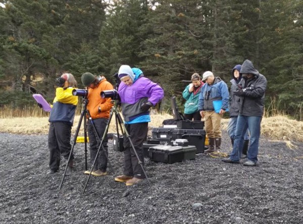
For the sea otter study, Daniel Monson, a wildlife researcher with the USGS Alaska Science Center, has been thinking for a couple of years about how unmanned aircraft might help scientists watch sea otters forage. Currently, researchers have to stand on a beach with high-powered spotting telescopes to watch how long an otter dives for food, what it brings up and how long it takes to eat the morsel, he said. The telescopes allow visuals to certain distances but don’t capture how and what sea otters eat farther from the beach. The telescopes can’t be used easily on a rocking boat, which is why observers stand on the shore.
Unmanned aircraft might solve the observation problem if they don’t alter the animal’s behavior. For the most part, the otters didn’t mind the whirring of the quadcopter and just kept eating, Monson said.
“I think it will be a useable tool,” he said. But it's more complicated than he imagined.
“At first I thought they were tiny helicopters and anyone could fly them,” he said. “After doing this, I know it’s a big job. We’ll probably have to have ACUASI do this for us for a while.”
ACUASI has a national certificate of authorization from the Federal Aviation Administration to fly UAVs, greatly simplifying the permissions necessary to use the aircraft professionally.
Monson imagines unmanned aircraft might be a good way to upload data from tagged animals without having to recapture them. They also might help monitor the remote coastlines of the Aleutian Islands, where it's difficult for manned aircraft to fly.

Imagining what unmanned aircraft might do and what they actually can do is often different. It’s a multistep process that starts slow, as in the case of these two missions, Vanderwaal said.
“We provide the aircraft and the team to fly them, and we’re experts,” he said. “But we also have to learn how to integrate the aircraft into their process.”
ADDITIONAL CONTACTS: Sam Vanderwaal, 907-455-2028 or s.vanderwaal@noremsol.com, Brenda Konar, 907-388-6745, bhkonar@alaska.edu, or Daniel Monson, 907-230-7139, dmonson@usgs.gov


