Study: Bering Sea ice extent is at most reduced state in last 5,500 years
September 2, 2020
Jeff Richardson
907-474-6284

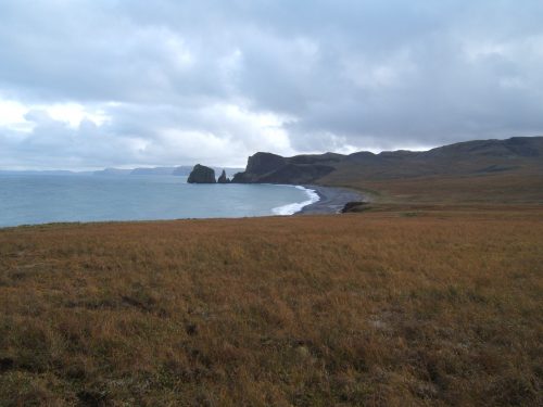
Through the analysis of vegetation from a Bering Sea island, researchers have determined that the extent of sea ice in the region is lower than it’s been for thousands of years.
A newly published paper in the journal Science Advances describes how a peat core from St. Matthew Island is providing a look back in time. By analyzing the chemical composition of the core, which includes plant remains from 5,500 years ago to the present, scientists can estimate how sea ice in the region has changed during that time period.
“It’s a small island in the middle of the Bering Sea, and it’s essentially been recording what’s happening in the ocean and atmosphere around it,” said lead author Miriam Jones, a research geologist with the U.S. Geological Survey. Jones worked as a faculty researcher at the University of Alaska Fairbanks when the project began in 2012.
The ancient sea ice record comes in the form of changes in the relative amounts of two isotopes of the element oxygen— oxygen-16 and oxygen-18. The ratio of those two isotopes changes depending on patterns in the atmosphere and ocean, reflecting the different signatures that precipitation has around the globe. More oxygen-18 makes for an isotopically “heavier” precipitation, more oxygen-16 makes precipitation “lighter.”
By analyzing data from a model that tracks atmospheric movement using the isotopic signature of precipitation, the authors found that heavier precipitation originated from the North Pacific, while lighter precipitation originated from the Arctic.
A “heavy” ratio signals a seasonal pattern that causes the amount of sea ice to decrease. A “light” ratio indicates a season with more sea ice. That connection has been confirmed though sea ice satellite data collected since 1979, and to a smaller extent, through the presence of some microorganisms in previous core samples.
UAF’s Alaska Stable Isotope Facility analyzed isotope ratios throughout the peat layers, providing a time stamp for ice conditions that existed through the millennia.
After reviewing the isotopic history, researchers determined that modern ice conditions are at remarkably low levels.
“What we’ve seen most recently is unprecedented in the last 5,500 years,” said Matthew Wooller, director of the Alaska Stable Isotope Facility and a contributor to the paper. “We haven’t seen anything like this in terms of sea ice in the Bering Sea.”
Jones said the long-term findings also affirm that reductions in Bering Sea ice are due to more than recent higher temperatures associated with global warming. Atmospheric and ocean currents, which are also affected by climate change, play a larger role in the presence of sea ice.
“There’s a lot more going on than simply warming temperatures,” Jones said. “We’re seeing a shift in circulation patterns both in the ocean and the atmosphere.”
Other contributors to the paper include Max Berkelhammer of the University of Illinois at Chicago, Katherine Keller of Harvard University, and Kei Yoshimura of the University of Tokyo.
The full Science Advances article is available at http://bit.ly/uaf0902201.
ADDITIONAL CONTACTS: Miriam Jones, 707-798-3540, miriamjones@usgs.gov; Matthew Wooller, 907-750-8786, mjwooller@alaska.edu


