

Hyperspectral imaging of forests can aid wildfire prevention
Rod Boyce
907-474-7185
Dec. 17, 2021
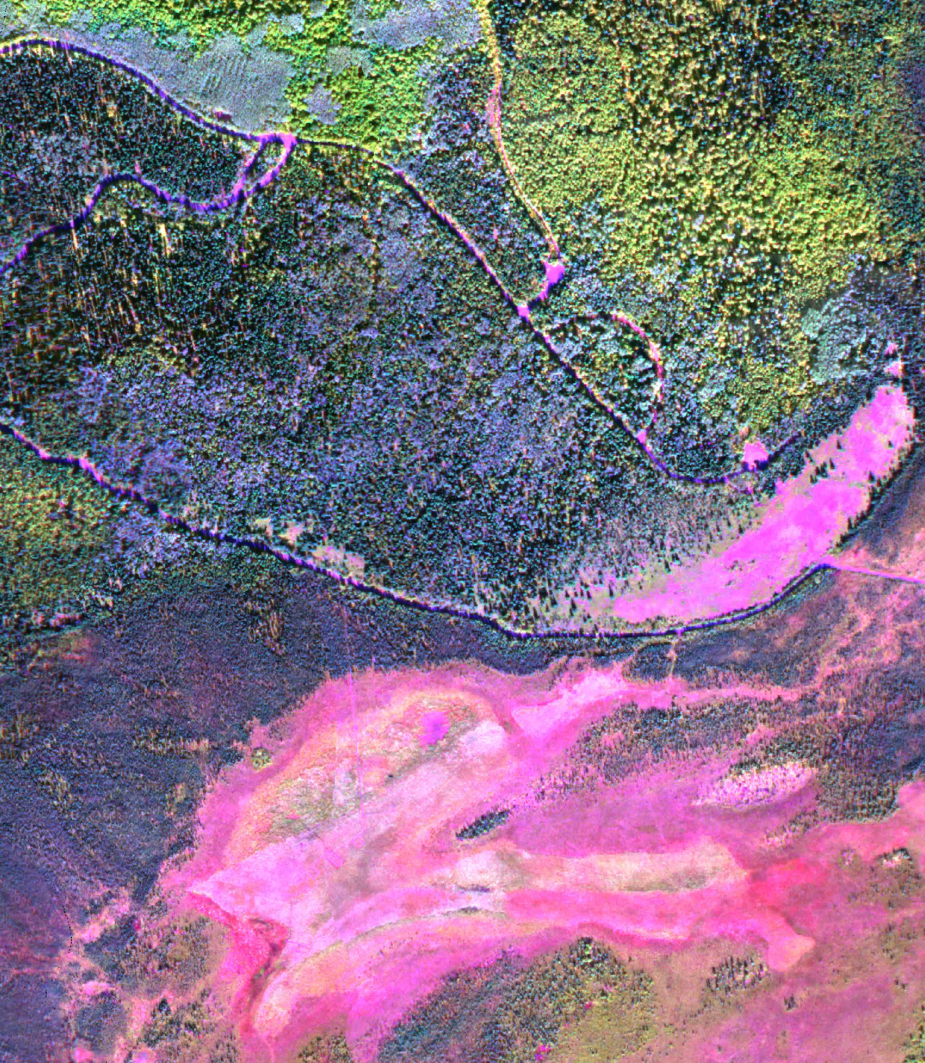
This processed image from a hyperspectral camera shows a variety of vegetation types, including open and closed aspen and white spruce forest, shown in medium-bright green; closed quaking aspen forest, shown in bright green; and open black spruce and black spruce/paper birch forest, shown in various shades of dark green. It also shows sedge meadows, wetlands and bare ground, all in shades of pink.
University of Alaska Fairbanks scientists are presenting their work at the American Geophysical Union’s fall meeting in New Orleans this week. This article is part of a series highlighting UAF research from the world’s largest Earth and space science meeting.
Airborne hyperspectral imaging can be a valuable tool in wildfire prevention and forest management. That’s the message from a technology demonstration by a University of Alaska Fairbanks postdoctoral fellow who imaged Interior Alaska’s boreal forests to develop the method.
The practice demonstrated by Chris Waigl of the UAF Geophysical Institute provides highly detailed imagery that indicates fuel type and that can also be used to monitor fuel condition — right down to the species of an individual tree. Is it a black spruce? Is it a birch? Is it alive?
It’s all vital information for wildfire prevention and community risk assessment.
“With the images and spectra we get from the HySpex camera, we can actually classify each pixel,” Waigl said. “We can even identify individual trees.”
Hyperspectral cameras image an area in hundreds of wavelengths across the electromagnetic spectrum, including many not visible to the human eye. That differs from other cameras, which typically only image in the primary colors of red, green and blue.
In hyperspectral imagery, the reflectivity of an object can reveal much more information about that object.
The Geophysical Institute has the only hyperspectral imaging facility in the state at its Hyperspectral Imaging Laboratory.
Waigl said hyperspectral imaging can be used for forest management, wildfire prevention and monitoring of fire risk around communities and infrastructure.
“We're doing this because the existing fuel maps are not very good,” she said.