

News of the Arctic from New Orleans
Ned Rozell
907-474-7468
Dec. 16, 2021
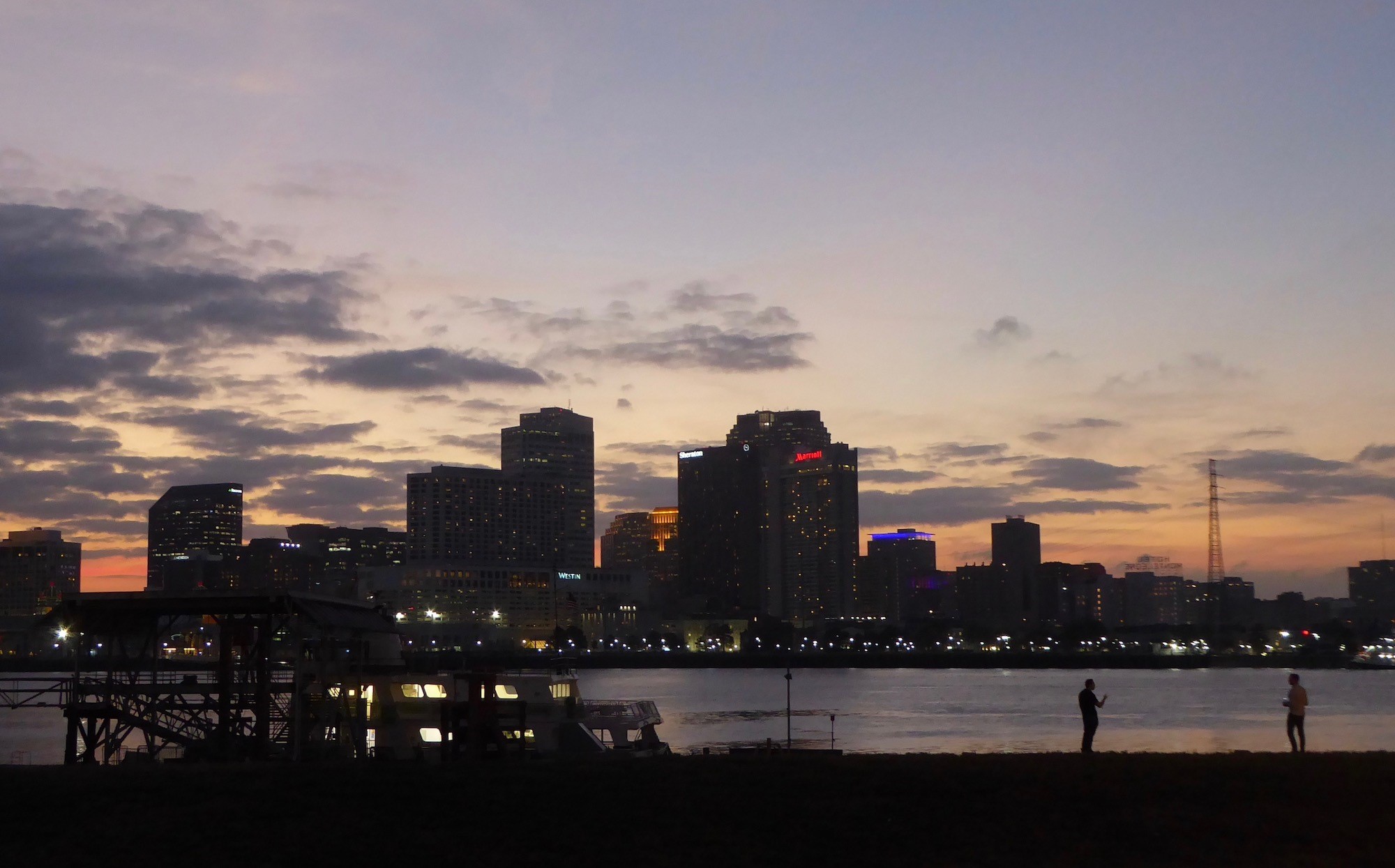
The Mississippi River flows past New Orleans at sunset.
NEW ORLEANS — Like everything in the past year-plus, the fall meeting of the American Geophysical Union is a bit different than it was before.
This year, for example, the meeting is here in sunny, humid New Orleans rather than San Francisco, the traditional gathering spot of more than 20,000 scientists each December.
Though scientists shared online presentations last year, there was no in-person conference due to the COVID-19 pandemic. In December 2021, mask-wearing researchers are back together on this U-shaped bend of the lower Mississippi River.
But no scientist was in the press-conference room to discuss the 2021 version of the Arctic Report Card, a product of the National Oceanic and Atmospheric Administration. The only person in the gymnasium-size space was me. Everyone else was logging in via Zoom. So I did too.
Here’s what we saw and heard: One-hundred and 11 experts on the land, ocean and ice north of the Arctic Circle pitched in to write the 2021 Arctic Report Card. The trends scientists spoke of in 2006 — the first report card — have become more extreme since then.
Some highlights:
• Scientists camped on the ice at 10,000 feet on the Greenland ice sheet felt raindrops in August 2021, the first rainfall ever documented up there, where snow is the norm.
• The raft of sea ice floating on the Arctic Ocean occupied the smallest acreage ever recorded in April 2021. Sea ice, which reflects sunshine and helps make the Arctic the refrigerator of the world, is now very young and thin, making it vulnerable to being bashed around by storms (small pieces melt faster than large pieces).

A map and chart show warming of the Arctic compared to the rest of the world. The image was released as part of NOAA’s Arctic Report Card for 2021 at the fall meeting of the American Geophysical Union in New Orleans, Dec. 14, 2021.
The editors of the report card added a few new observations to the 2021 version:
Scientists are finding waters of the Bering Strait, (shared by the U.S. and Russia) are becoming much noisier due to more industrial ship traffic. Alaska residents of the region have noticed more garbage floating ashore recently.
As ice cover decreases in the Bering Strait and the Arctic Ocean, more ships are steaming through both northward and southbound, including Russian vessels whose captains are following the Northern Sea Route. There, ships hug the coast through the Bering Strait and continue northward, curving westward around Russia to reach the Atlantic Ocean.
Kate Stafford and her colleagues have lowered hydrophones into the Bering Strait since 2009. They hear increasing manmade noises there in what was an underwater version of a rainforest, rich with marine mammal songs.
“(The ships) are traveling right through bowhead whale winter core-use habitat when bowheads are in Anadyr Strait, and are singing,” said Stafford, an expert on underwater soundscapes who works at the University of Washington. “This is a potential disruption on their breeding and calving grounds.
“They have not been extensively exposed to (ships and their noises, including air
guns fired for seismic testing) in the past — certainly not in the dead of winter
as occurs now.”
In late July 2020, villagers all along the Bering Sea coast noticed a lot more trash
on their beaches.
Nome-based Gay Sheffield of Alaska Sea Grant, part of the University of Alaska Fairbanks, worked alongside those in coastal communities during the pandemic summer of 2020 to document and clean up an “unprecedented” amount of floating litter.
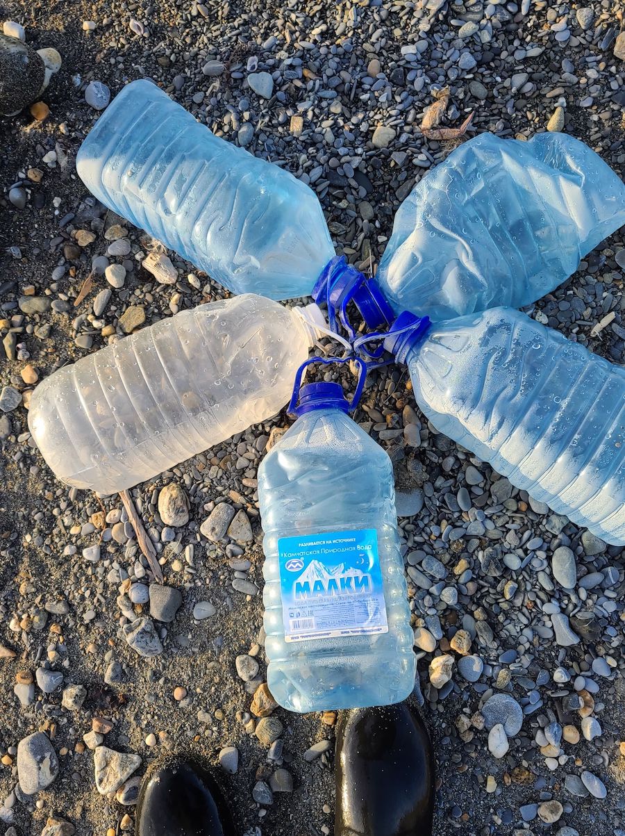
Trash lies on a beach after being gathered by a Bering Strait village resident in summer 2020.
“There is trash and debris for miles along the shoreline,” an observer in the village of Savoonga reported in July 2020.
“Lots of Russian plastic (water) jugs,” someone from Unalakleet noted in August.
Sheffield and her partners from along Alaska’s western coast documented more than 350 items that washed ashore, “most with Russian, Korean, and/or Asian lettering.”
They found water bottles, plastic tubes of men’s body wash and 47 orange deck boots.
“There was no clothing or hygienic debris typically associated with women or children, which supports attributing this mass-debris event to commercial fisheries, which employ mostly male crew members,” Sheffield wrote in the Arctic Report Card.
“If there is no enforcement of existing international pollution laws, expect a trashy Arctic,” Sheffield said. “Think of the marine wildlife — that are also people’s food — dealing with toilet-bowl-cleaner bottles and garbage bags floating in the ocean.”
Since the late 1970s, the University of Alaska Fairbanks Geophysical Institute has provided this column free in cooperation with the UAF research community. Ned Rozell is a science writer for the institute.