

Researchers work to predict long-term flood hazards
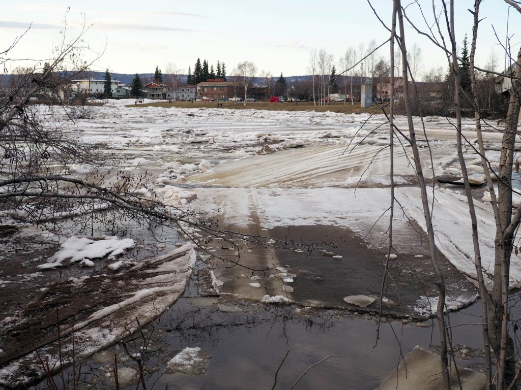
Breakup is underway on the Chena River in Fairbanks during 2020. A new UAF-led effort is working to predict future hydrological changes in Interior rivers, including the Chena.
Jeff Richardson
907-474-6284
Dec. 16, 2021
University of Alaska Fairbanks scientists are presenting their work at the American Geophysical Union’s fall meeting in New Orleans this week. This article is part of a series highlighting UAF research from the world’s largest Earth and space science meeting.
A new University of Alaska Fairbanks-led effort is working to predict how the changing hydrology of the Chena, Salcha and Chatanika rivers could alter the potential for flooding events during the next half-century in the Tanana Valley.
Since the Fairbanks area is intertwined with those rivers, long-term shifts to those watersheds could greatly affect its people and infrastructure. Better monitoring is important as climate change rapidly alters the Arctic ecosystem, causing more extreme weather events, said UAF researcher Alec Bennett.
“We’re trying to understand what might change, and what it means for flooding events that require a bit of advance notice, or might alter the ecosystem,” said Bennett, who works at UAF’s International Arctic Research Center and College of Business and Security Management. Bennett is collaborating with other researchers at UAF, as well as partners at outside institutions.
The National Center for Atmospheric Research has developed a widely used hydrology model for Lower 48 rivers. UAF researchers and their collaborators are working to adapt it to Alaska watersheds, where frozen ground and other cold-weather dynamics are more common.
Inputs in the project include river flow data from 2001-2018, historical reanalysis data and future climate projections from the Intergovernmental Panel on Climate Change.
The team plans to use those tools and data for selected decades to create projections for river flow, stretching out to 2070. A better understanding of long-term flood risks could allow planners to identify shortcomings, allowing them to reduce the risks to communities and infrastructure.