

Satellite launch means continued timely information for Alaskans
Rod Boyce
907-474-7185
Nov. 11, 2022
Thursday’s launch of an environmental satellite aboard an Atlas V rocket from Vandenberg Space Force Base in California might not register as a big thing for Alaskans, but it is.
The satellite, once in full operation, will bring timely data about the weather, sea ice, wildfires and much more to Alaskans for the next seven years.
Data from that satellite and others comes into the Geographic Information Network of Alaska at the University of Alaska Fairbanks Geophysical Institute. GINA turns that data into products that monitor wildfire, sea ice and weather.
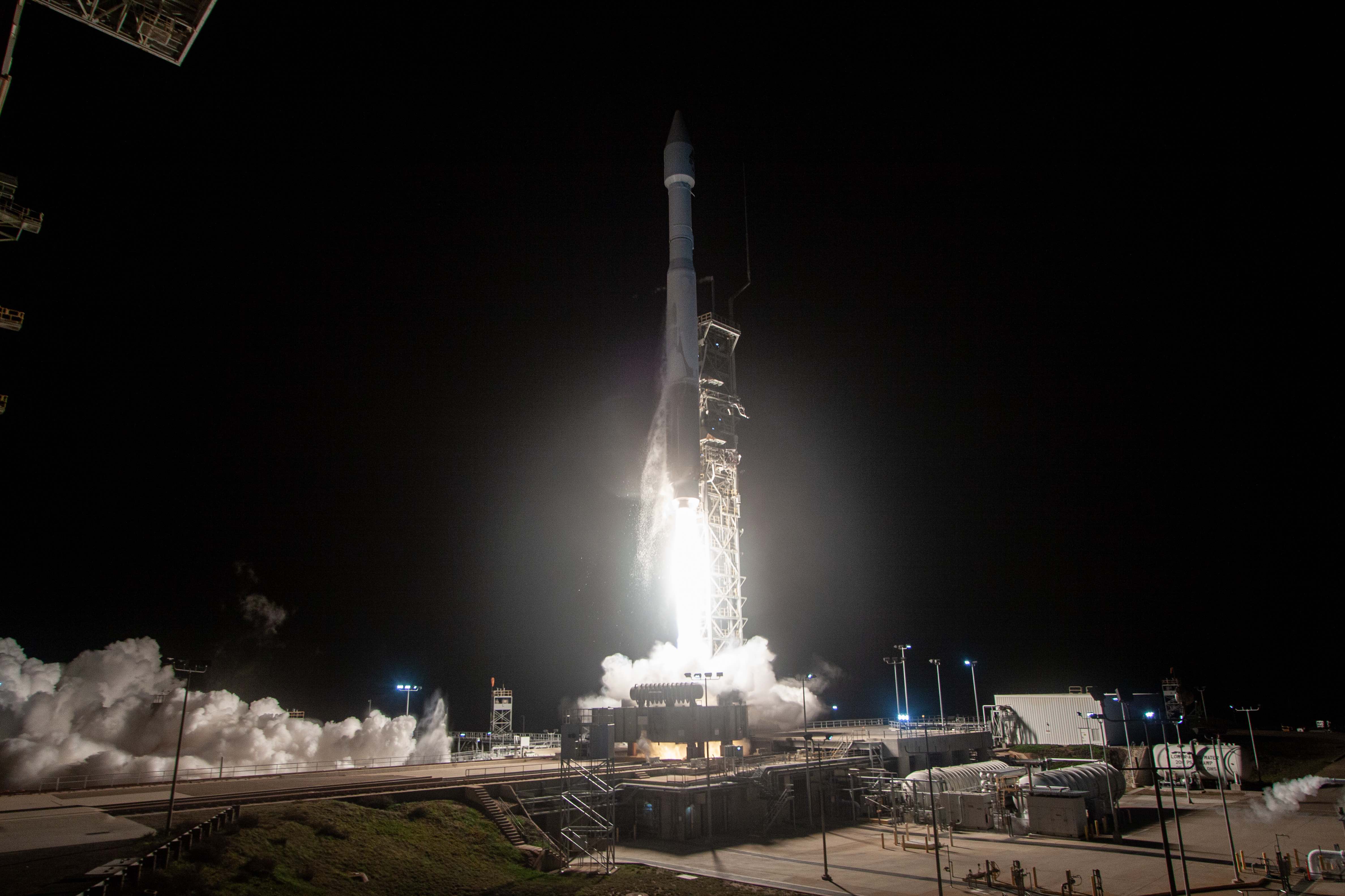
A United Launch Alliance Atlas V rocket carrying the Joint Polar Satellite System civilian polar-orbiting weather satellite for the National Oceanic and Atmospheric Administration and NASA’s Low-Earth Orbit Flight Test of an Inflatable Decelerator tech demo lifts off from Vandenberg Space Force Base in California on Nov. 10, 2022.
“For us, it just means we get to keep having this incredible data,” GINA Director Jennifer Delamere said.
The JPSS-2 satellite joins two other polar-orbiting satellites in the National Environmental Satellite Data and Information Service. The satellite is part of the Joint Polar Satellite System, which is a collaboration of NASA and the National Oceanic and Atmospheric Administration.
The Suomi NPP satellite, launched in October 2011, is the oldest. The other satellite is NOAA-20, which launched in November 2017.
JPSS-2, which will be renamed NOAA-21, is expected to operate for seven years.
Having two satellites with staggered lifespans gathering data about all facets of Earth is a must, not only for redundancy in case one satellite fails but also for continuous acquisition of climate data. The satellites all carry the same instruments so the type of data retrieved is consistent.
Each satellite makes one polar orbit of Earth every 100 minutes.
Alaska’s high latitude means ground stations in the state can communicate with polar-orbiting satellites more often than stations at lower latitudes can. Each satellite passes over Alaska eight to 14 times a day, improving the timeliness of the products GINA produces.
Other satellite launches for the National Environmental Satellite Data and Information Service are set for 2028 and 2032.

Technicians lift the JPSS-2 satellite to a stand inside the Astrotech Space Operations facility at Vandenberg Space Force Base in California.
The Alaska Satellite Facility played a crucial role in providing tracking of JPSS-2 not long after the Atlas V rocket launched at 12:49 a.m. Alaska time. Tracking information helps NASA model the orbit.
“When a satellite is launched, it takes some time for the orbit to get settled,” said Devan Larson, one of the satellite facility’s ground station engineers. “The satellite will have to make additional maneuvers and adjustments.”
“It is very important to have accurate tracking data early on to aid in moving the spacecraft to its final orbit,” he said.
NASA reported on its blog early Thursday that JPSS-2 is receiving and responding to commands.
UAF Vice Chancellor for Research Nettie La Belle-Hamer noted the work of the two Geophysical Institute units.
“This is a fantastic example of how ASF and GINA are working together for the betterment of not just the Geophysical Institute but for UAF and all of Alaska,” she said.
ADDITIONAL CONTACTS: Jennifer Delamere, jsdelamere@alaska.edu; Devan Larson, usa@asf.alaska.edu
085-23