

The galloping glacier’s recent dramas
Ned Rozell
907-474-7468
Aug. 23, 2024
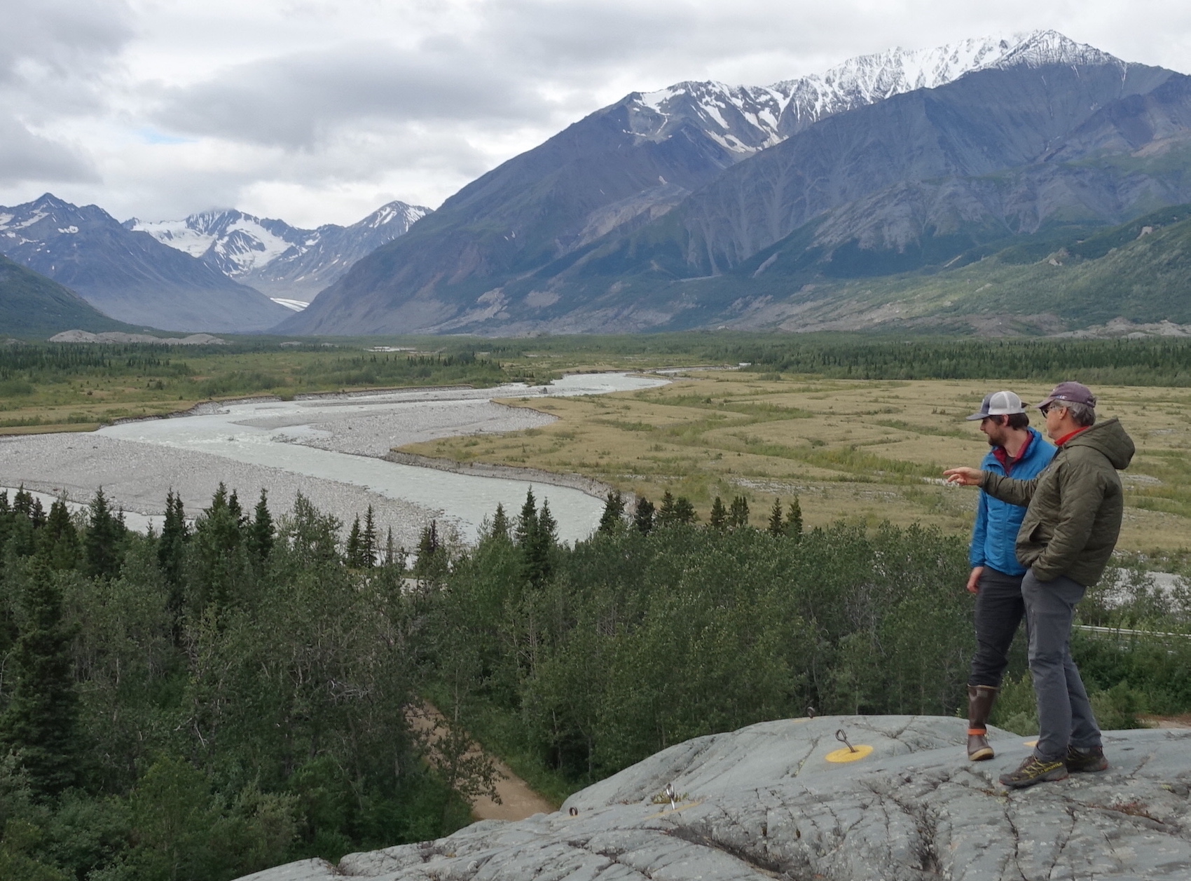
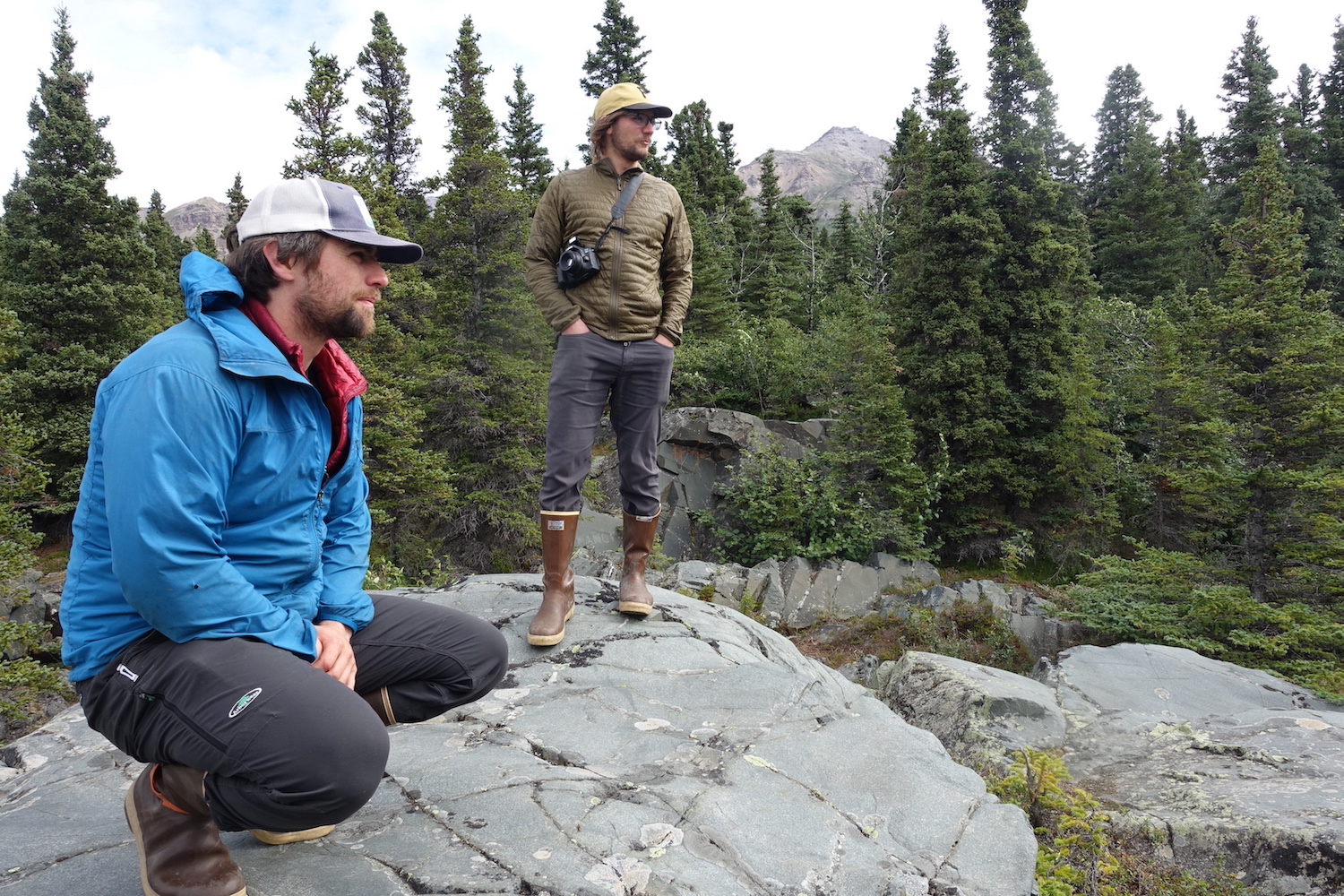
Phillip Wilson, in the blue jacket, and Dan Mann stand on a rock outcrop that was scoured by floodwaters a few centuries ago when Black Rapids Glacier — far in the distance — advanced to dam the Delta River.
BLACK RAPIDS OF THE DELTA RIVER — If we climb high enough above this tumble of gray water, we can see a wedge of blue-white ice withering into the mountains.
Less than one century ago, Black Rapids Glacier was much more conspicuous.
Then, in 1937, what scientists call a “surging” glacier was rumbling across the valley toward a roadhouse along a major Alaska highway. That mountain of ice advanced upon the log structure at more than 100 feet each day.
Then — as surging glaciers often do — it stopped as suddenly as it had started. It then began a retreat that continues today.
There are a few dozen surging-type glaciers in Alaska; they suddenly get up and go after long periods of not advancing. The recharge time between the surges of Black Rapids Glacier — during which it gains great weight in high-altitude ice and snow — is about 100 years.
In a quiet phase and reacting to recent warming, Black Rapids is now a shrinking 26-mile long tongue of ice. It has attracted the attention of a group of scientists who drove me down here to the Alaska Range from Fairbanks for the day. They are reading the marks that Black Rapids Glacier has etched into the land over the centuries.
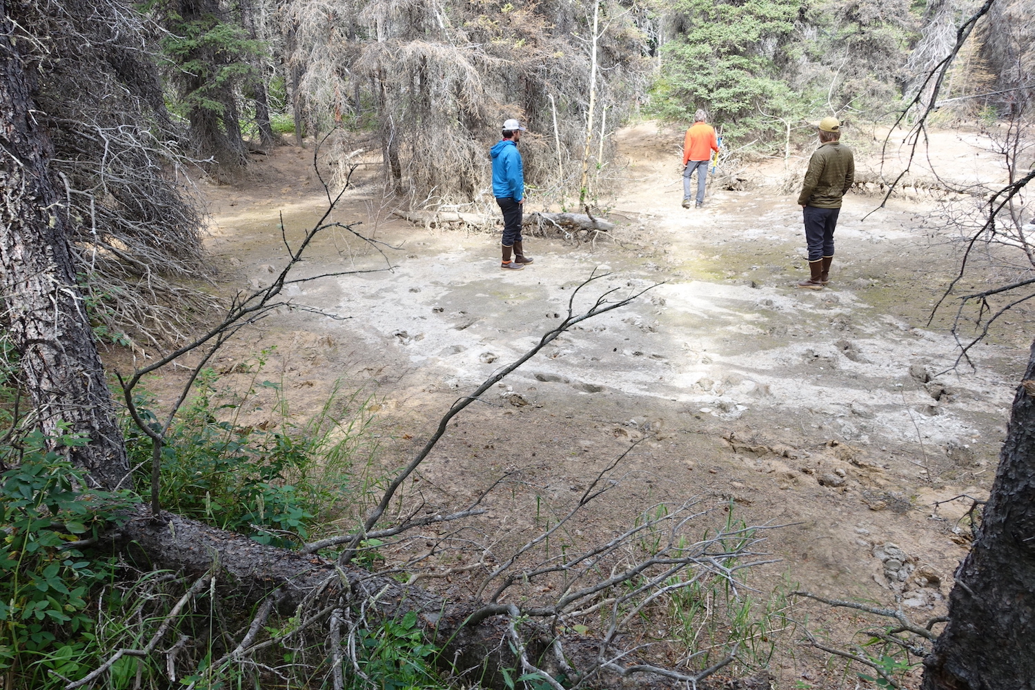
Scientists walk in a crater left behind by an iceberg stranded more than 300 years ago in a flood event caused by Black Rapids Glacier.
Today, Dan Mann, Phillip Wilson, and Ben Gaglioti — all affiliated with the University of Alaska Fairbanks — are reviewing the evidence of Black Rapids Glacier’s prehistoric surges.
Phillip drove me down in his camper van, in which he lives while working around the state. At 28, he is the youngest of the researchers and the one with the most time on the ground here. He was born in a log cabin nearby in Delta Junction.
Phillip met Dan when Phillip was a geology student enrolled in Dan’s Ice Age Alaska class at UAF. After seeing that Phillip had a knack for reading landscapes and seemed weatherproof, Dan helped Phillip find funding to start learning more about Black Rapids Glacier.
We follow the Richardson Highway to visit sites that preserve clues to what Black Rapids Glacier has been up to during the last 400 years. It has been busy.
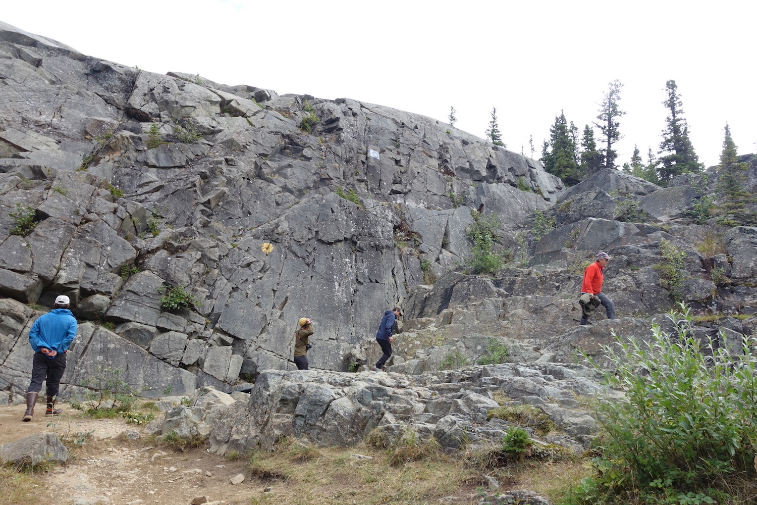
Scientists scale a rock face south of Delta Junction that was scoured bare by floodwaters from the failure of a glacial ice dam hundreds of years ago.
These signs of the glacier’s past actions — not one of which I had noticed before on dozens of Richardson Highway drive-bys over the years — include rock faces scoured clean, buried stumps, and house-size craters in the nearby spruce woods.
These are all indicators of past surges of Black Rapids Glacier, several of them dramatic enough to dam the Delta River. In plugging up the river, the glacier created large, narrow lakes that backed water past the Castner Glacier, more than 10 miles away.
The water in those lakes eventually melted through the great ice dams, triggering catastrophic floods that left icebergs the size of houses stranded on the valley floor downstream of today’s Black Rapids Lodge.
Evidence of a flood in the early 1700s is the polished wall of the military rock-climbing facility near Falls Creek. The rock is slick because it sat beneath a waterfall created when the glacier surged across the Delta River and diverted its flow. When the dam broke around 1703, the resulting flood was comparable to the volume and intensity of the Yukon River.
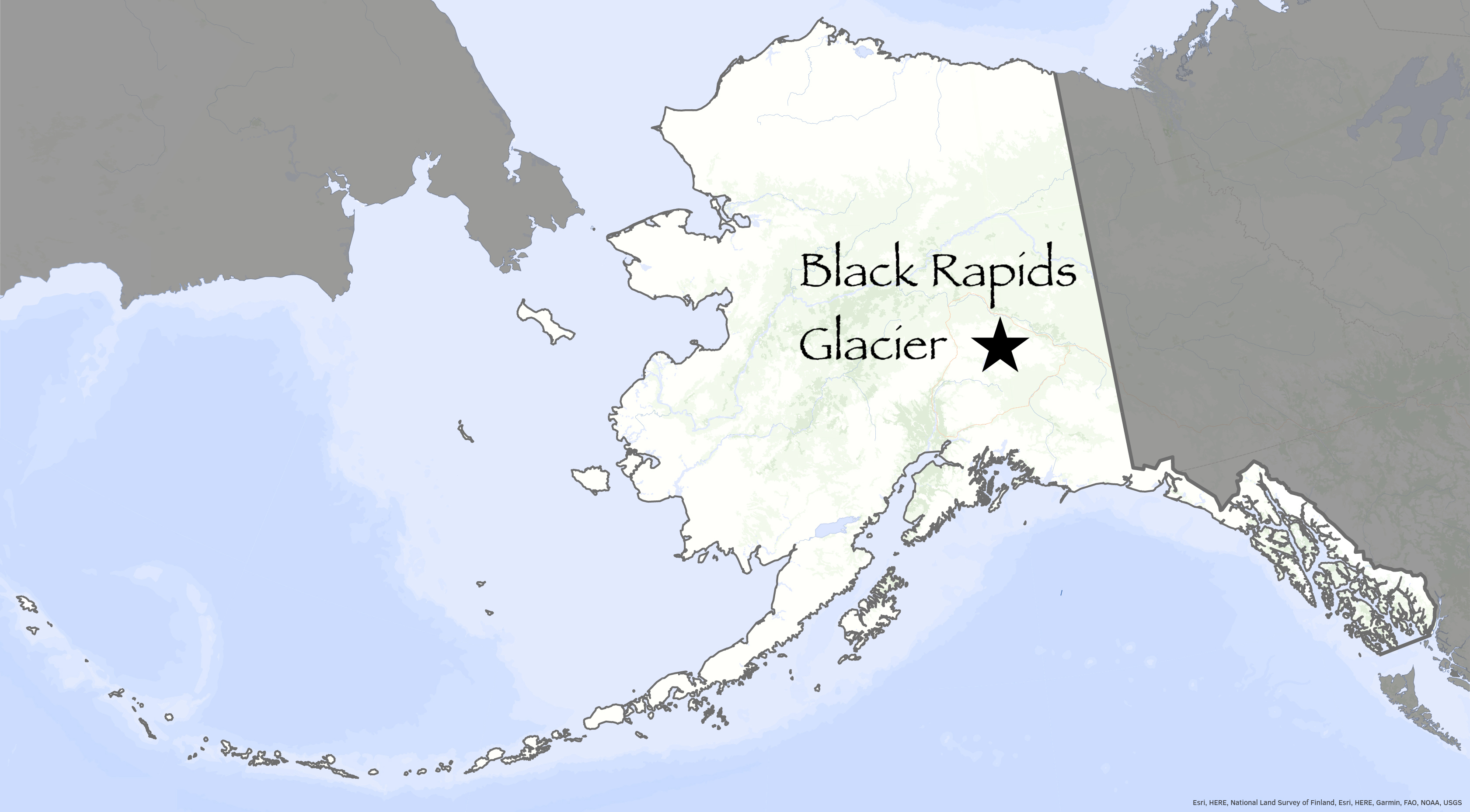
A star on a map of Alaska identifies the location of Black Rapids Glacier.
“This was under the spout of the whole Delta River, which must have been incredible,” Wilson said as he walked up the bare rock for a view of the valley.
Later in the day, we visit a grove of spruce and poplar trees a few miles north of Black Rapids Lodge. Here, 30 years before George Washington was born, a wall of water left a giant iceberg behind.
What remains is a massive crater in which trees now grow. The hole from the long-gone iceberg is still 30 feet deep.
There are many similar pocks within the Delta River valley. They are hard to find today because the forest has moved in. The scientists were able to see the divots on detailed lidar imagery from the Alaska Department of Transportation.
Detective work by Phillip, Dan and Ben also includes the ring-dating of buried tree stumps that were drowned by lakes created by the glacier’s advance. They also used the sizes of a particular species of lichen growing on boulders as another way to determine the years since the last outburst flood.
Phillip Wilson, left, listens to Dan Mann talk about the surges of Black Rapids Glacier at a military training site south of Delta Junction.
Using all these clues, they have learned that Black Rapids Glacier has surged four times since the year 1400. One of the largest in the mid-1600s dammed the huge lake that drained in the outburst flood of 1703.
Black Rapids’ active past is another reminder that what we see today on the landscape is not what people saw just a few hundred years ago.
“This place is not as sleepy as it looks,” Mann says.
Since the late 1970s, the University of Alaska Fairbanks' Geophysical Institute has provided this column free in cooperation with the UAF research community. Ned Rozell is a science writer for the Geophysical Institute.