The numbers behind a weather forecast
Ned Rozell
907-474-7468
Oct. 31, 2024

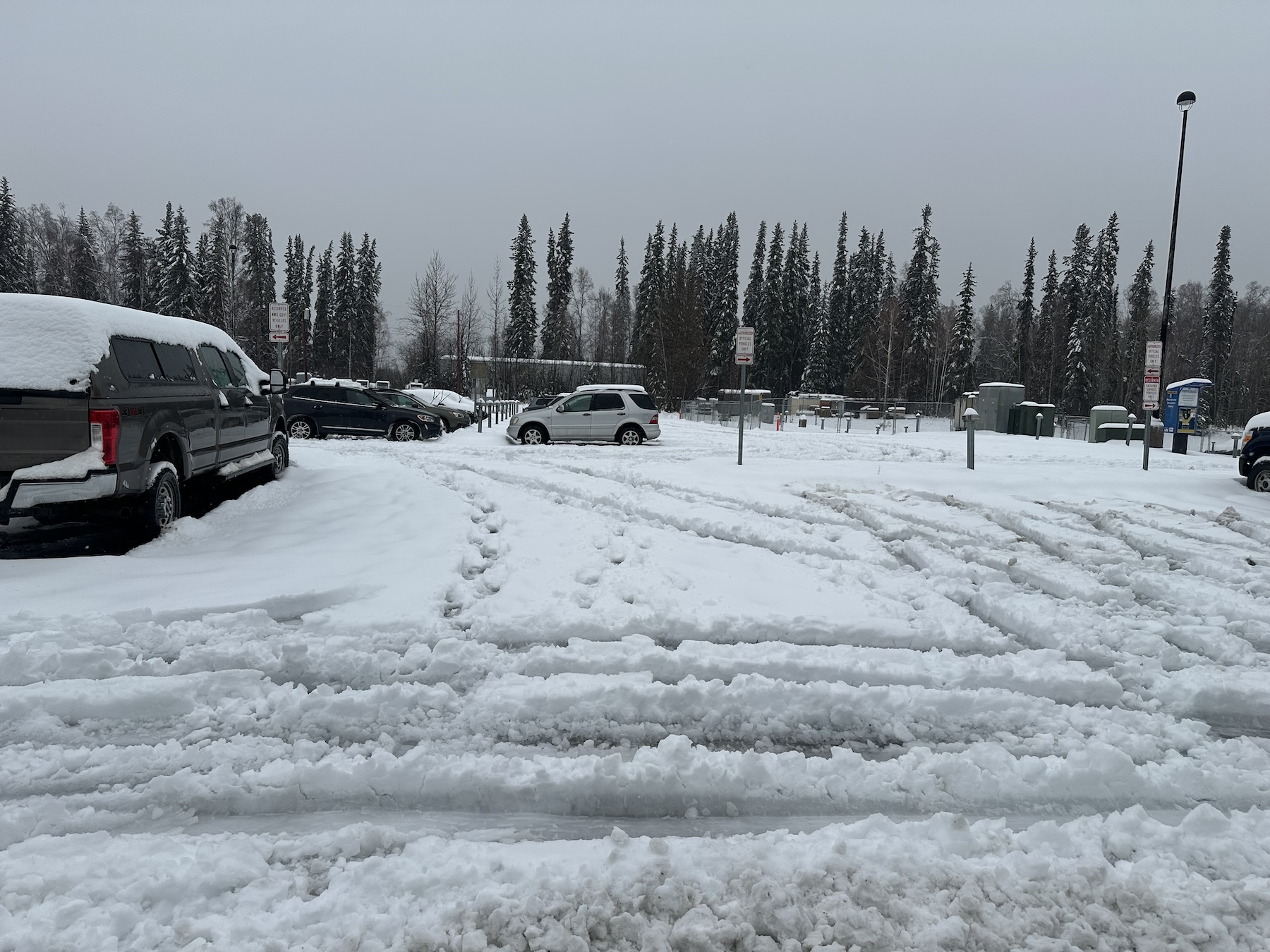
Fairbanks’ first winter storm of October 2024 left behind this uncommon wet, slushy mess.
A meteorologist from the National Weather Service’s local office recently told a newspaper reporter that heavy, wet snow would materialize in a few days. He said it would resemble “cement falling from the sky.”
Three days later, I grunted to lift a shovel blade full of heavy slush. How did that weatherman call this from three days out, when skies were clear and there was no sign of a winter storm?
After we all dug out, I looked up Bobby Bianco, the meteorologist.
I asked Bianco how he dared use the word cement when Fairbanks snow always resembles dried potato flakes.
“It’s a term I’ve heard used on the East Coast quite a bit for wet, heavy, waterlogged snow,” said Bianco, who grew up on Long Island, New York.
Predicting cement wasn’t a tough call, Bianco said. He and his colleagues rely on two main sources: computer models of Earth’s dynamic atmosphere and forecasters’ personal experience. All those models lined up to boost their confidence in predicting that unusual event, which manifested as 1.99 inches of combined precipitation and became Fairbanks’ third wettest day on record.
Meteorologists rely on the work churned out by people they never see. Those people feed weather information to supercomputers all over the world. The products of those supercomputers are digital representations of the entire planet’s atmosphere.
“They were all showing similar results,” Bianco said of the weather models in the days before the event. “We had confidence it was going to be a big storm with snow changing to rain (in the Fairbanks area).”

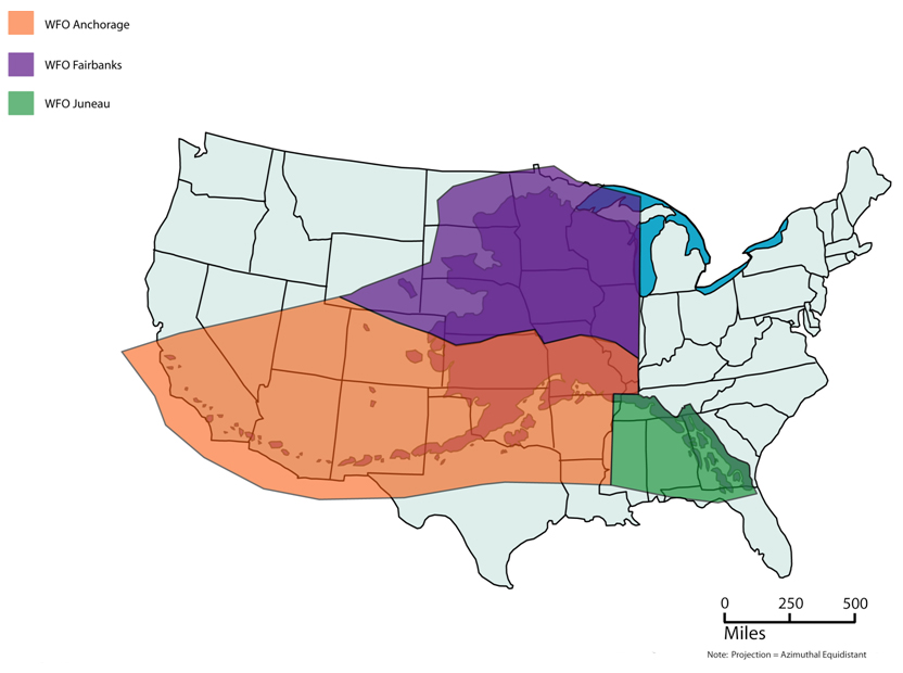
Alaska’s three forecast offices of the National Weather Service — Fairbanks in purple, Anchorage in orange, and Juneau in green — cover areas that would span the Lower 48 states.
How did they know the snow was going to change to rain? The system that was ushering in the snow was also pulling warmer air from the surface of the Bering Sea. That air would raise temperatures above freezing during the storm. A friend who was sitting on his snow plow reported that the forecasters even nailed the precise time that snow changed to rain.
Bianco said one of the most valuable models to which the weather service subscribes is the European Centre for Medium-Range Weather Forecasts, which updates twice each day. That weather-prediction product comes from researchers and a supercomputer housed in Reading, England.
That gymnasium-size bank of connected computers performs a million billion calculations each second (30 petaflops!).
A colossal computer representing weather over the entire planet needs that much power. The supercomputer combines the human inputs of satellite data, aircraft observations, weather balloons, stream gauges and other sources, and then crunches those numbers through complex equations based on the physics of Earth.
Meteorologists look at graphic maps produced by the varied computer models. Sometimes the models don’t agree. That’s when forecasters rely on their own past experiences and those of their co-workers.
“You need the human element to look at a model and say, ‘No, this isn’t right,’” Bianco said.
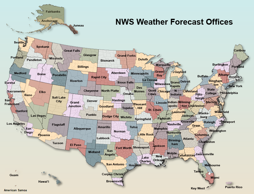
Another challenge to forecasting weather in Alaska is the amount of country meteorologists need to cover. There are just three weather service regions in Alaska: Fairbanks, Anchorage and Juneau. Compare that to the 13 different forecast offices in which meteorologists predict the weather just for the state of Texas.

This map — not to scale when considering Alaska or Hawaii — shows the National Weather Service regional offices across the United States.
The half-dozen meteorologists in the Fairbanks office predict weather for the entire state north of the Alaska Range. That’s about 610,000 square miles, more than twice the space Texas occupies.
Sometimes — such as during the recent cement-snow event that impacted most of northern Alaska — all the meteorologists on staff come into the office to help with forecasts and get the word out to people like you and me, along with managers of state agencies and the military, and everyone else interested in the weather.
Bianco said the disruptive rain-upon-snow event that jumpstarted winter was so consistent within the models that the forecasters did not even need to tweak their special weather statement as the storm evolved.
“Within the office, we were very proud of this one,” he said.
Since the late 1970s, the University of Alaska Fairbanks' Geophysical Institute has provided this column free in cooperation with the UAF research community. Ned Rozell is a science writer for the Geophysical Institute.


