

Time Lapse Imagery
Toolik Field Station began taking time-lapse photographs in February 2007 to document spatial and temporal patterns of snow accumulation and melt. Daily images are captured close to noon Alaska Standard Time. Six time-lapse cameras are mounted in the vicinity of TFS and two webcams are located in TFS buildings. We also host photos from AON's Imnavait Creek study site on this page.


Atigun River
Instrumentation: Campbell Scientific CC640 Digital Camera System inside a Pelco EH4700 Environmental Enclosure
Operation: Sep 2007
Location: The system is permanently mounted on a 10m tower near the Atigun River 2 bridge crossing of the Dalton Highway. It faces southeast. An area extensively studied for Arctic ground squirrels and Smith's Longspur bird surveys. (68.4532222 -149.367681)

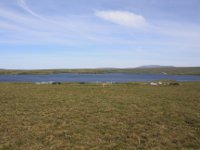
Toolik Inlet
Instrumentation: (1) Pentax K200D SLR Digital Camera remotely operated by a Harbortronics DigiSnap 2000, (2) Buckeye X7D Wireless Camera
Operation: (1) Jul 2009 - Sep 2013, (2) Sep 2013
Location: The system is permanently mounted on the 10 m tower attached to the Winter Quarters building at the Toolik Field Station. It faces southwest. The study area comprises the inlet bay to Toolik Lake and an east-facing hillside. (68.626617 -149.594436)

Toolik Lake West
Instrumentation: Axis 206W Wireless Network Camera
Operation: Sep 2009
Location: The system is permanently mounted inside Winter Lab and faces north towards the main body of Toolik Lake. (68.6275474 -149.597953)

Toolik Lake North
Instrumentation: Buckeye X7D Wireless Camera (MacIntyre)
Operation: Jan 2015
Location: The system is mounted overlooking Toolik Lake on the south shore of the lake, looking north. The view from the camera includes the deepest spot on the lake.

Brooks Range
Instrumentation: Axis 206W Wireless Network Camera
Operation: Sep 2009
Location: The system is permanently mounted inside Winter Quarters and faces south towards the Brooks Range. (68.6266163 -149.594349)
Moist Acidic Tundra
Instrumentation: (1) Pentax K200D SLR Digital Camera remotely operated by a Harbortronics DigiSnap
2000,
(2) Buckeye X7D Wireless Camera
Operation: (1) Sep 2011 - Sep 2013, (2) Sep 2013
Location: This system is mounted overlooking moist acidic tussock tundra on the ridgeline to the west of the field station. The camera faces north toward Toolik Lake. The view includes transects used for NDVI measurements and snow monitoring. (68.6229144 -149.612117)

Heath Tundra
Instrumentation: (1) Pentax K200D SLR Digital Camera remotely operated by a Harbortronics DigiSnap
2000,
(2) Buckeye X7D Wireless Camera
Operation: (1) Sep 2011 - Sep 2013, (2) Sep 2013
Location: This system is mounted overlooking heath tundra near the Toolik airstrip, looking north. The view from the camera includes transects used for NDVI measurements and snow monitoring. (68.6395512 -149.587022)

Heath Snow Fence
Instrumentation: Buckeye X7D Wireless Camera
Operation: Jan 2015
Location: The system is mounted above the Moist Non-Acidic Tundra snow fence south of Toolik Field Station, looking north. The view from the camera includes the footprint of the snow fence, Toolik Field Station, and a portion of Lake Toolik. (68.622215, -149.598060)

Imnavait Creek
Instrumentation: (1) Sony SNC-RZ30N Webcam, (2) StarDot Technologies NetCam MP
Operation: (1) Nov 2008 - Feb 2011, (2) From Aug 2011
Location: The system is mounted on a 4 m tall tower on the ridge crest of the Imnavait Creek study site. It faces southeast toward the AON flux tower instrumentation. (68.6058 -149.311)
(Latitude and Longitude are decimal degrees WGS84 datum)
Other Time-Lapse Imagery
Instrumentation: StarDot NetCam SC IR (Infrared and RGB imagery)
Operation: 2017-02-24-present, pictures taken every 15 minutes, uploaded once a day.
Location: The camera is mounted midway up the the NEON Tower facing North. The study area
comprises tussock tundra (N 68.6611, Long -149.3705, Elev (m) 827).
Instrumentation: StarDot NetCam SC IR (Infrared and RGB imagery)
Operation: 2017-02-24-present, pictures taken every 15 minutes, uploaded once a day.
Location: The camera is mounted on the top of the the NEON Tower facing North. The study area
comprises tussock tundra (N 68.6611, Long -149.3705, Elev (m) 827).
Instrumentation: StarDot NetCam SC IR (Infrared and RGB imagery)
Operation: 2018-07-17-present, pictures taken every 15 minutes, uploaded once a day.
Location: The camera is mounted on the southeast shore of Toolik Lake overlooking the NEON lake
level gauge. Camera is facing North (N 68.6296, Long -149.6105, Elev (m) 715).
Instrumentation: StarDot NetCam SC (RGB imagery)
Operation: 2012-06-05 to 2018-06-17, pictures taken once an hour, pictures loaded biannually.
Location: The camera is mounted on the AON Fen Eddy Covariance Tower at Imnaviat Creek, the
camera is facing North. The study area comprises tussock tundra and wet sedge (N
68.6058, Long -149.3110, Elev (m) 900).
Instrumentation: StarDot NetCam SC (RGB imagery)
Operation: 2012-08-28 to 2019-06-12, pictures taken once an hour, pictures loaded biannually.
Location: The camera is mounted on the AON Ridge Eddy Covariance Tower at Imnaviat Creek, the
camera is facing South East . The study area comprises tussock tundra and dry heath (N 68.6068, Long -149.2958, Elev (m) 951).
Instrumentation: StarDot NetCam SC (RGB imagery)
Operation: 2012-06-04 to 2019-05-23, pictures taken once an hour, pictures loaded biannually.
Location: The camera is mounted on the AON Ridge Eddy Covariance Tower at Imnaviat Creek, the camera is facing North. The study area comprises tussock tundra and dry heath (N 68.6068, Long -149.2958, Elev (m) 951).
Instrumentation: StarDot NetCam SC (RGB imagery)
Operation: 2012-07-10 to 2020-10-13, pictures taken once an hour, pictures loaded biannually.
Location: The camera is mounted on the AON Tussock Eddy Covariance Tower at Imnaviat Creek, the camera is facing North. The study area comprises tussock tundra (N 68.6063, Long -149.3041, Elev (m) 918).