
Collect, Validate, Trust
By Logan Borger
March 24, 2023
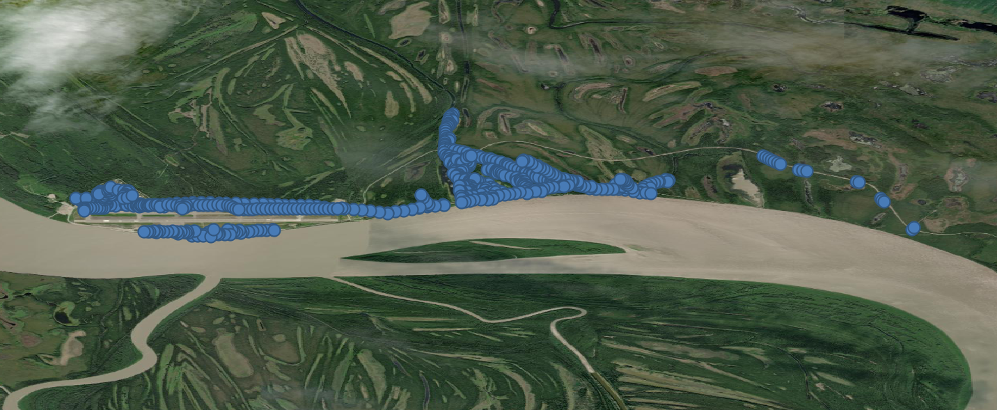
This is a portion of the mapped power poles in Galena. Each point has an associated pole number and qualitative data on tilt and erosion.

As we ventured around Galena, Corban introduced me to many of the local dogs, who were always very fond of him!
Early in my collegiate career, I knew I was interested in the energy scene for rural Alaskan communities. In the fall of 2019, I found a flier for ACEP’s summer internship program and was intrigued. It seemed like the perfect opportunity to go to a rural village and see if a career in rural energy was something I wanted to pursue. At the end of the day, I wasn’t able to travel due to COVID, but I have really enjoyed learning about rural Alaska and the energy challenges they face. And even though it took a few years, I did get the opportunity to spend some time in Galena, Alaska this past summer.
Late last June, I was sent to the village of Galena to map some of the power infrastructure for two weeks. This was my first time being in a small community. I immediately noticed that everyone I met was exceptionally friendly and hospitable. There were ample people who reached out to make me feel welcomed, which I greatly appreciated. The people of Galena have a certain heartiness and resourcefulness about them that I found to be refreshing. I very much enjoyed being removed from a somewhat urban setting and being free to four-wheel around and explore the village.
Galena has a population of about 470 people and is situated on the Yukon River in between the adjacent villages of Koyukuk and Ruby. The village is divided into two main sections: a residential area with the K-8th grade school, and a section dedicated to the Galena Interior Learning Academy (GILA) and industry.
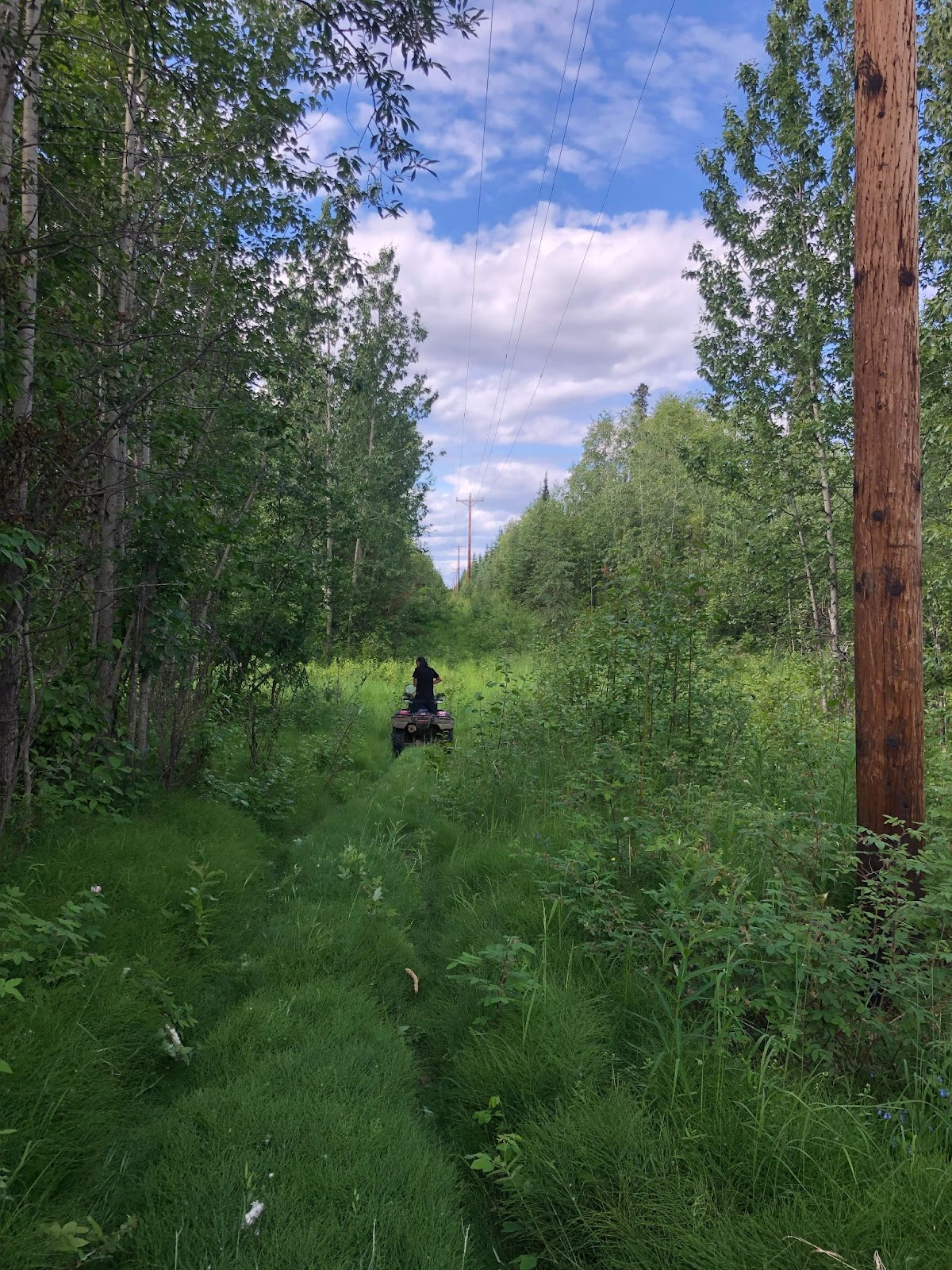
Corban leading the way to collect the GPS coordinates for some power poles.
During my time in the village, I was tasked to map each of the power poles spread throughout the community. I worked alongside Corban Sommer. He is a local drone pilot and sophomore at Fort Lewis College who is studying Environmental Science. It was extraordinarily helpful to have someone who knew their way around and was acquainted with everyone. Corban was tasked to work on this project by Tim Kalke, our primary contact in Galena. He’s the general manager for Sustainable Energy for Galena Alaska (SEGA), a non-profit organization and joint initiative between the Galena City School District, the City of Galena, and Louden Tribal Council, tasked with biomass fuel harvesting and processing. Tim voiced SEGA's interest in mapping the microgrid for training linemen and inventorying the biomass potential in nearby areas. These goals aligned with our work at ACEP, and we were excited to support them.
It turned out there were 633 power poles spread throughout Galena. We walked, or four-wheeled, to each of them. Our mission was to collect their GPS coordinates, take photos, and conduct some qualitative analysis. This analysis included recording tilts of poles, notable erosion, and shadow visibility.
One key thing we did each night was take the time to verify the data. Corban and I compared the GPS points collected throughout the day to Alaska High Resolution Imagery (RGB). During the first couple of days, we noticed that some of the data was off. If we had skipped this step, likely many of the points would have been incorrectly located. We were using a cell phone app called OsmAnd to acquire the GPS points. We learned that sometimes the signal was weak, and it would take extra time to get a good lock on stable coordinates. By comparing the coordinates against the imagery, we could see if they were in the right place and confirm our method was working.

Power poles in this area are susceptible to erosion and standing water, which can cause tilting.
This was an important lesson for me: collect, validate and then trust data.
Reviewing the data also gave us a chance to reflect each day about how well we were doing holistically. This was my first time independently collecting a large amount of data, and figuring out how to do so efficiently. Collaborating with Corban was very helpful as we worked together to optimize how many poles we could locate each day. Initially, I was concerned by the setbacks we faced during our early stages of data collection. I was a bit worried that we wouldn’t be able to map the whole community and that the data might not be good quality. But as we figured the system out, I gained confidence in our process. We ended up having the perfect amount of time to complete the entire survey -we finished up the last poles on my final day in the community.
After returning home, I was able to map the power poles in QGIS and provide data to those working with Galena’s power. Further post-processing included creating an AutoCad format to aid in the visualization of a potential solar array. In the future, the data will need to be reorganized with the help of the linemen, so that the poles are properly labeled and more easily referenced. While the data can still be refined in these ways, all the pieces are there for producing useful maps. And the methodology stands to be useful, not only for mapping power poles, but for mapping other infrastructure as well. This might entail going back to Galena at some point and conducting GIS training for linemen.
Overall, I am very grateful for the opportunity to have traveled to Galena to do field work. Thank you to Erin Trochim, Jeremy Kasper, and Tim Kalke for laying the groundwork for the trip and providing ample support along the way. Thank you to the Scottons for providing a place to stay and being admirably friendly and hospitable. Thank you to Colter Scotton for lending me his yellow hat. Thank you to Stephanie Fischer and Noelle Helder for being field work savvy and patiently guiding me through the process. Finally, thank you to Corban Sommer for all the help in the field and willingly following me on mosquito-infested bushwacking extravaganzas for power poles that didn’t exist even though you knew better.
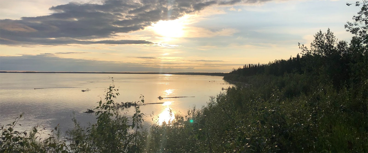
A pretty view of the Yukon from Galena.
