
Drone Photography Assists in Creating 3D Aerial Model of Yakutat Beach
During the end of May and early June, Alaska Hydrokinetic Energy Research Center researchers were in Yakutat, Alaska, to conduct a multibeam bathymetry survey and
perform a land survey of Cannon Beach. The survey will allow the creation of a 3D
map of the beach using AHERC’s drone, a DJI Phantom 3 Professional.
This work is part of the Bureau of Ocean Energy Management-funded Wave Energy Converter Study, AHERC's continuing assessment of the possibility
of wave energy in Alaska.
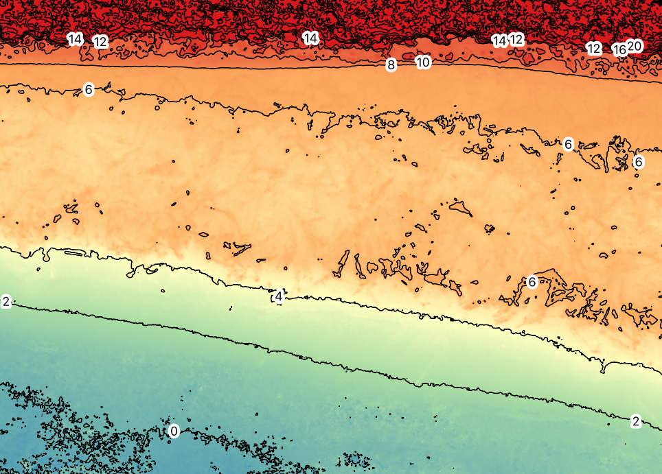
AHERC research engineer Paul Duvoy is the in the final stage of processing the aerial pictures to produce a digital elevation model of a 10-kilometer section of Cannon Beach with a resolution of 19 centimeters per pixel. The 3D model will also be used to create orthophotos — aerial pictures rectified for topographic relief, lens distortion and camera tilt.
The land survey consisted of 20 ground transects and approximately 1,000 points measured using a Trimble RTK base and rover. This combined aerial and ground survey will assist researchers in characterizing the erosion processes of Cannon Beach, the northwestward migration of the Situk River’s mouth and the river’s deposition of large woody debris on the beach.
Above is a digital elevation model made from an orthophoto, a series of aerial photographs rectified for topographic relief, lens distortion and camera tilt.
