
Ocean Floor Data to Predict Coastal Erosion
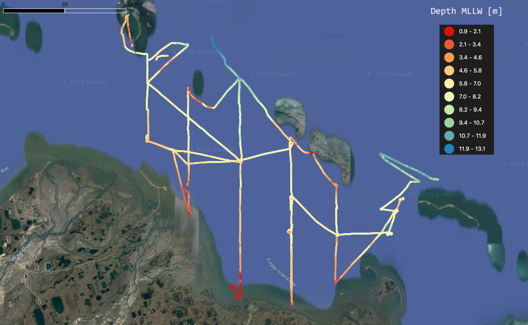
ACEP research engineer Paul Duvoy has post-processed bathymetry data collected in summer 2018 in Foggy Island Bay in the Beaufort Sea. This work effort is part of the federal Bureau of Ocean Energy Management-funded project, the "Central Beaufort Sea Wave and Hydrodynamic Modeling Study."
This information will be used for high-resolution wave model and hydrodynamic model
outputs to assess current and future wave conditions. The outputs will help assess
wave impacts on offshore oil and gas structures and on sedimentation patterns and
coastal erosion around the nearshore Beaufort Sea. The analysis is being conducted
by ACEP partner Li Erikson at the U.S. Geological Survey’s Pacific Coastal and Marine Science Center.
Foggy Island Bay Bathymetry. Image by Paul Duvoy.