
Buoy Maintenance Ensures Second Year of Data Collection
The Yakutat area on the Gulf of Alaska coast is famed for its powerful waves, even being a surf destination for many. Two Sofar Ocean wave buoys, deployed off Cannon Beach in 2019, measure those waves, improving the Pacific Marine Energy Center regional estimates of wave energy. Understanding and predicting this energy could help harness it to generate electricity for the local community.
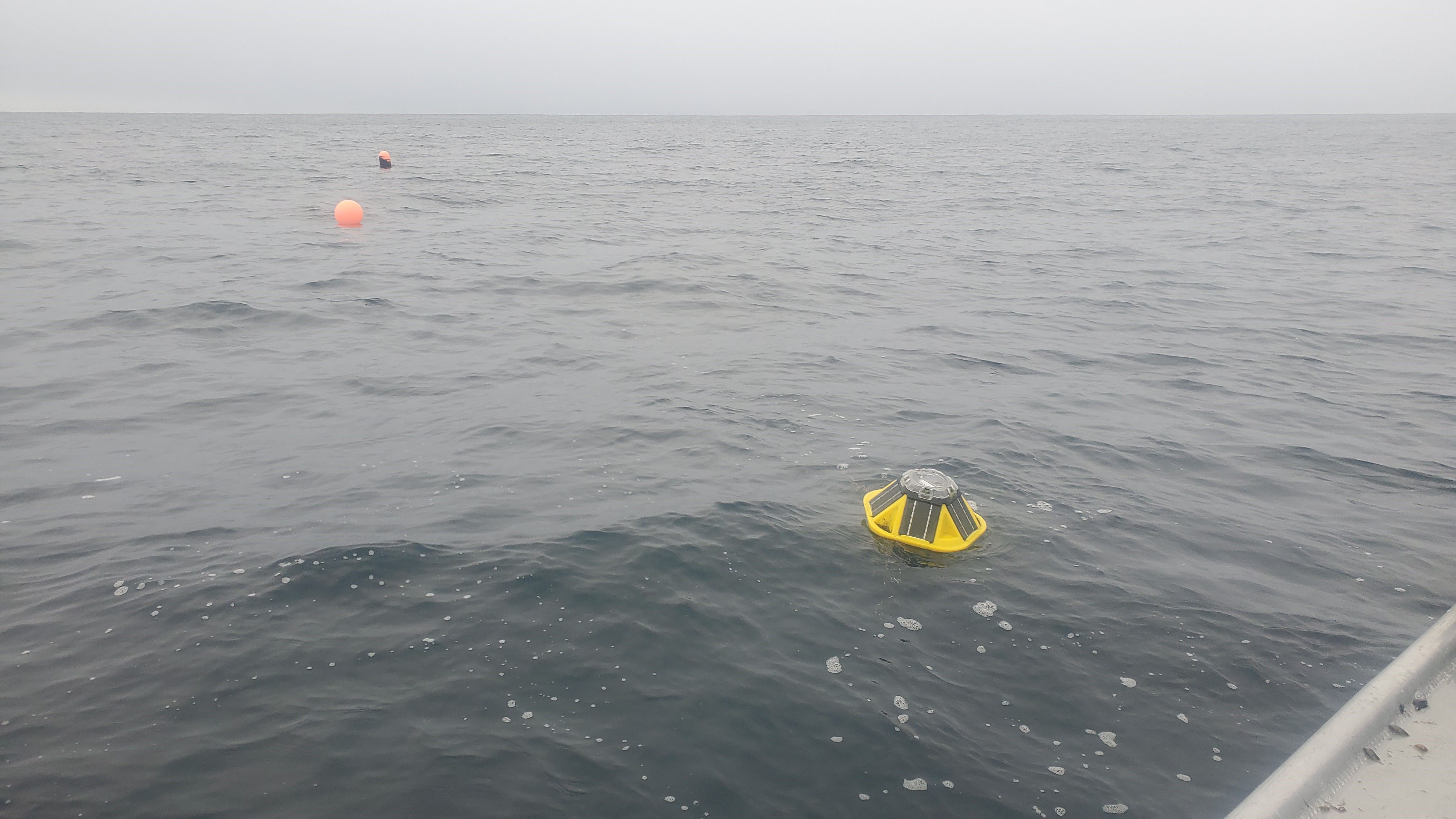
In early November, the two buoys were serviced and placed back into the rolling waves. The Yakutat coast has strong storms throughout the winter, and the maintenance should help the buoys collect data for a second winter. Data from the buoy is available in real-time from the Sofar Dashboard: https://spotters.sofarocean.com/?user-filter=54.
The Sofar Ocean buoys are small (16.4 inches by 12.2 inches) and lightweight compared to Coastal Data Information Program wave buoys. The buoys transmit most of their data once an hour via satellite for tracking significant wave height, peak and mean period, direction, and spread in near real-time. Spectrum data collected by the buoys are stored internally on a SD card; this data is collected during servicing.
These buoys are moored in 60 meters and 120 meters of water. Both had their anchors and surface floats upgraded last winter to help them maintain their mooring location. These data sets will be combined with additional wave buoy data and data from moored sensors deployed from 2018 and 2019 to provide a detailed look at the wave resource in the region.
While the wave buoys were safely charging on land before being redeployed, ACEP’s Stephanie Jump and Taylor Poirrier worked on a U.S. Army Corps of Engineers Engineer Research and Development Center project that is researching secure and resilient power generation in cold-region environments. The two researchers conducted an aerial survey of a section of Cannon Beach; this is the third consecutive year this area has been surveyed. The images will be stitched together and analyzed to help researchers improve their ability to map, understand and predict terrain evolution at sites of interest to the U.S. Department of Defense. Six control points are used to allow researchers to overlay drone images accurately.
This research was funded in-part by Sandia National Lab and the U.S. Army Engineer Research and Development Center (U.S. Army Program 633734T1500, Military Engineering Technology Demonstration) project “Secure and Resilient Power Generation in Cold Region Environments.”
A Sofar Ocean wave buoy floats on top of the ocean waves off Cannon Beach near Yakutat. Photo by Stephanie Jump.