GIS Equipment
Last updated 07 June 2025
GPS Base
Toolik Field Station maintains a continuous GPS base station for use by the Toolik community and the general public. The base station runs continuously year-round with files permanently archived and available for download. Learn more about TLK2 on the NGS NCN Station Pages site: https://geodesy.noaa.gov/CORS/ncn_station_pages/index.html?stationID=tlk2.

Receiver: Trimble NetR8 Survey Grade w/internal batteries, external power, internal storage, web interface
Receiver Antenna: Trimble Zephyr Geodetic 2 ROHS (TRM57971.00)
Radio: Pacific Crest RFM96W, 2 watt and 35 watt toggle, Astron 12V 2.5A power supply, broadcast frequency: 464.500MHz, broadcast antenna: Base Omni 5dB
Computer: Dell PowerEdge 2400, Pent III, 1GHz, 1Gb RAM, Linux Fedora
Software: Custom File Conversion Script - UNAVCO
Mobile GPS Base
Toolik Field Station provides mobile GPS base stations with radio link for RTK for use by the Toolik community on an as needed basis. The base stations can be set up over known benchmarks or post-processed for base coordinate solution. Additional mobile base stations are made available to TFS during the summer field season by Earthscope (formerly UNAVCO).

Receivers: Trimble NetR9 | Trimble R9s
Receiver Antenna: Trimble Zephyr Geodetic Model 2, w/ 30m cable. Solar panel charging available.
Radio: Pacific Crest RFM96W, 2 watt and 35 watt toggle, Astron 12V 2.5A power supply, broadcast frequency: 464.500MHz, broadcast antenna: 1m 5dB Whip or 10cm rubber
| Method | Typical Accuracy | Occupation Time | Typical Applications |
|---|---|---|---|
| Continuous | < 0.5cm | Months or more | Crustal deformation, geophysics, reference stations |
Survey Grade Rover
Toolik Field Station provides survey grade field GPS services for registered users, administrators and managers. Accuracies range from greater than 10cm to sub-centimeter depending on distance from base station and field method (see tables below). Applications include but are not limited to: Stream channel morphology, Archiving of research plot locations, Facility / building survey, Localized, fine-scale DEM creation, Long-term glacial and tectonic monitoring, Precise landscape metrics

Receiver Antennas:Trimble R10, Internal 410-470 MHz Rx/Tx Radios. GPS, GLONASS & SBAS Sats Enabled
Receiver Controllers: Trimble TSC7
Bipod/Rangepole: Trimble 2m carbon fiber
| Method | Typical Accuracy | Occupation Time | Typical Applications |
|---|---|---|---|
| Static | 0.5-5cm | Hours to days | Crustal deformation, geodetic control, very long baseline surveys, geophysics |
| Rapid static | 1-5cm | Minutes | Short baseline surveys, glaciology |
| Kinematic | 1-5cm | Seconds | Short baselines, closely spaced points, vehicle positioning, feature surveys, GIS and mapping |
Mapping Grade Rover
ToolikGIS provides a range of mapping grade receivers for use by station residents, administrators and managers. Researchers should utilize a GPS unit that is mapping-grade or above to record field sites. With minimal processing after the user returns from the field, the data can be distributed in a variety of formats including tabular (e.g. excel), GIS (shapefile, coverage), or delimited text. To check out a GPS unit please go to the equipment page on the myToolik site.
Receiver A: Trimble GeoXT, with 2m antenna (Windows Mobile) (Navigation only)
Receiver E: Trimble Geo7x, with 2m antenna (Windows Mobile)
Receiver F: Trimble Geo7x, with 2m antenna (Windows Mobile)
Receiver G: Trimble Geo7x, with 2m antenna (Windows Mobile)
Receiver H: Trimble Geo7x, with 2m antenna (Windows Mobile)
| Method | Typical Accuracy | Occupation Time | Typical Applications |
|---|---|---|---|
| Code differential | 50-300cm | Seconds | Coarse GIS, mapping, positioning |
| Carrier differential | 15-100cm | Minutes | GIS, mapping, positioning |
High Resolution Bathymetric Unit
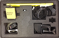
ToolikGIS provides a high resolution bathymetric unit that we use to collect bathymetric data in lakes, streams and ponds around Toolik Field Station for registered users, administrators and managers. After data processing, ToolikGIS can use this data to create 2D and 3D bathymetric maps for use in field work or publications. Depth range for this unit is reported to be 0.3m - 75m. Resolution of the final product is limited by the extent of data collection - less time on the water requires more interpolation.

| Dimension | Typical Accuracy |
|---|---|
| Vertical | 1cm / 0.1% of depth |
| Horizontal | 5-30cm |


